This guide covers Surisan Provincial Park hiking trails that are accessible from Seoul, you’ve found the right guide. Tucked across Gunpo, Anyang, and Ansan cities in Gyeonggi Province, Surisan is a rewarding day-hike destination that most international visitors completely overlook — and that’s exactly what makes it special.
Contents
Getting There: Public Transport from Seoul
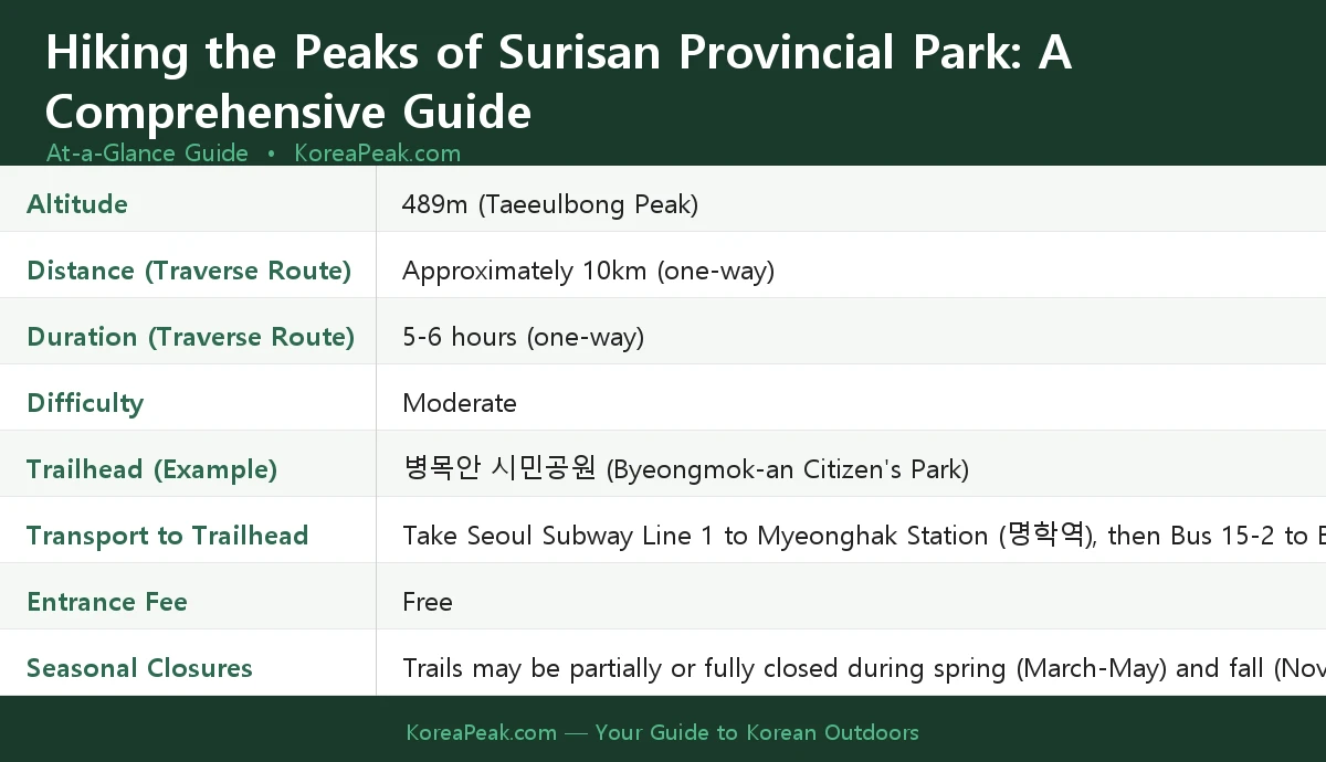
One of the best things about Surisan Provincial Park is how straightforward it’s to reach by public transport. Take Seoul Subway Line 1 to Myeonghak Station (명학역), then board Bus 15-2 toward Byeongmok-an Citizen’s Park (병목안 시민공원), which serves as one of the main trailheads. That said, bus routes in Korea do change — I recommend verifying the current bus number on Naver Map before you head out.
Speaking of Naver Map — a quick but important heads-up for international visitors: Google Maps doesn’t work reliably in South Korea for navigation. Use Naver Map (naver.com/map) or KakaoMap instead. To search for the trailhead, copy and paste this Korean text directly into the search bar: 병목안 시민공원. Both apps have English-language options and will give you accurate real-time transit directions.
The park is easily accessible from Seoul and other nearby Gyeonggi cities, making it a perfect weekend escape without the long travel times you’d face heading to more distant national parks.
Trail Guide: The Surisan Traverse Route
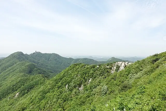
The most popular way to experience Surisan is the traverse route — a one-way journey that takes you through the park’s most prominent peaks before descending on the other side.
The Key Peaks Along the Route
The traverse route connects several of Surisan’s best-known summits. Here’s what you can expect along the way:
- Gwanmobong (관모봉) — one of the first major peaks you’ll encounter heading from the Byeongmok-an trailhead
- Taeeulbong (태을봉) — the highest point in the park at 489 metres above sea level, and the natural highlight of any traverse
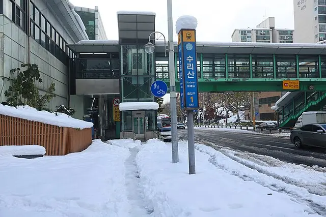
- Seulgibong (슬기봉) — a further peak often included in longer traverse routes, before the descent toward Surisan Station (수리산역)
Based on available information, the full one-way traverse is approximately 10km and takes around 5, 6 hours to complete. These figures are estimates drawn from Naver Map calculations and consistent reports across recent Korean hiking blogs, so treat them as a solid guideline rather than a guarantee, your pace and rest stops will naturally vary. The overall difficulty is rated moderate, making it suitable for hikers with a reasonable level of fitness and some trail experience.
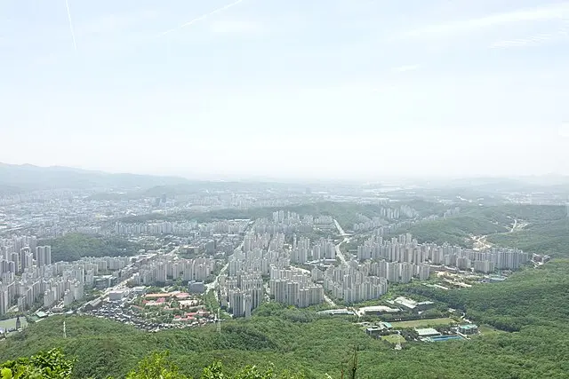
The trails offer a mix of rocky sections, forested paths, and open views of the surrounding cities, a satisfying combination that rewards the effort. For the most up-to-date trail information, I’d suggest checking the Official Gunpo City Tourism Page for Surisan Provincial Park before your visit.
Practical Tips for International Hikers
What to pack before the trailhead
This is non-negotiable: there are no shops, vending machines, or restaurants on the mountain trail. Once you pass the trailhead, you’re on your own for supplies. Before you start hiking, stock up at a convenience store near the trailhead or subway station. Pick up:
- Enough water for the full duration of your hike, water sources aren’t available on the trails
- Energy snacks like kimbap, triangle rice balls (삼각김밥), energy bars, or nuts
- Any blister plasters or small first-aid items you might need
Leave No Trace. Carry Out All Your Trash
Korean mountains have no trash cans anywhere on the trail. This is standard practice across the country and it keeps the mountains beautifully clean, but it means you need to carry a small bag for all your waste and bring everything back down with you. It’s a simple habit that every hiker here follows, and it makes a real difference.
General Rules to Follow
- Night hiking isn’t legally prohibited in Surisan Provincial Park, and it’s actually a popular spot for evening hikes. However, for safety, it’s recommended to plan your descent before dark if you aren’t experienced.
- Entrance to Surisan Provincial Park is completely free
- Wear proper hiking footwear, trail shoes or hiking boots are strongly recommended
- Dress in layers, especially in spring and autumn when temperatures can shift significantly between the valley and the summit
Seasonal Closures You Must Know About
This is one of the most important things to check before you go. Surisan’s trails may be partially or fully closed during spring (March. May) and fall (November. December) for fire prevention. These closures are strictly enforced and the specific dates change each year depending on weather conditions and fire risk assessments.
Always check the local government websites or contact Gunpo City’s tourism office for the exact closure dates before planning your trip. There’s nothing worse than arriving at the trailhead only to find the gate closed, a quick check beforehand saves the whole day.
Final Thoughts
Surisan Provincial Park is one of those underrated hiking destinations in the greater Seoul area, close enough for a comfortable day trip, varied enough to keep experienced hikers engaged, and free to enter. Whether you tackle the full traverse across Gwanmobong, Taeeulbong, and Seulgibong, or opt for a shorter out-and-back route from Byeongmok-an Citizen’s Park, you’re in for a rewarding day on the trails.
Just remember the essentials: load up Naver Map, search for 병목안 시민공원, grab your water and snacks at a convenience store before you start, pack out all your trash, and double-check the seasonal closure calendar. Do those things and you’re set for a great hike.
Have you already hiked Surisan, or are you planning your first visit? Which route are you considering, a quick summit hike to Taeeulbong, or the full traverse all the way to Surisan Station? Drop your questions or trip reports in the comments below. I’d love to hear how your hike goes!