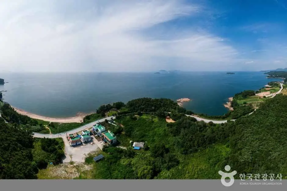
The Byeonsanbando coastal drive sunset experience is one of the most accessible on Korea’s west coast. The route runs approximately 15km from Byeonsan Beach (변산해변) to Gyeokpo Port (격포항), passing several well-known sunset viewpoints along the Yellow Sea. No entrance fee, no technical hiking required — just a car, a clear evening, and a bit of planning.
Contents
Quick Facts
| Distance | Approx. 15km (Byeonsan Beach to Gyeokpo Port) |
|---|---|
| Best Season | Autumn (September–November) for clear skies and vibrant sunsets |
| Difficulty | Easy — driving with short walks at viewpoints |
| Budget | Fuel and food/drinks. no national park entrance fee |
| Essential Gear | Car, camera, comfortable shoes for viewpoints |
| Key Warnings | Check local sunset times. expect traffic during peak hours and holidays |
The Route
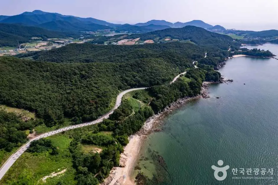
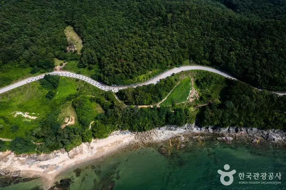
The coastal drive follows the western edge of Byeonsanbando National Park, covering approximately 15km between Byeonsan Beach and Gyeokpo Port. One section of the route is known locally as the Noeulgil (노을길), or Red Sunset Road, and it’s the stretch most visitors come specifically to drive. The road hugs the coastline closely enough that the light changes noticeably as you move between headlands and open water.
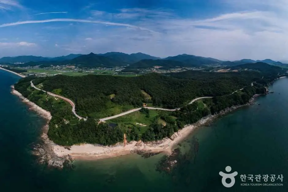
The drive is straightforward to navigate. There are no toll roads within the park, and the coastal sections are well-signed. Plan for more time than the distance suggests — stopping at viewpoints, waiting for the light, and finding parking at popular spots all add up.

Key Sunset Viewpoints
Three spots along the route are consistently worth stopping at:
- Chaeseokgang (채석강) — The most distinctive stop on the drive. The site is known for its layered rock formations along the shoreline, and the angle of the late afternoon sun across those formations is what draws photographers. Arrive with enough time to walk down to the rocks before the light drops.
- Gyeokpo Port (격포항) — A working fishing port at the western end of the drive. The combination of boats, open water, and the western horizon makes it a reliable sunset spot, and there are food stalls and restaurants nearby if you want to eat after the light fades.
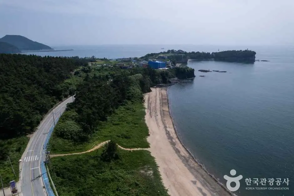
- Gosapo Beach (고사포해변) — A quieter option compared to Chaeseokgang. The beach faces west and offers an unobstructed view of the horizon, which suits people who prefer open water over dramatic geology.
For full details on the official route and viewpoints, see the Korea Tourism Organization’s Byeonsanbando coastal drive page.
Best Time to Go
Autumn — September through November, is the most reliable season. Skies tend to be clearer than in summer, when haze and humidity can flatten the light considerably. The temperature is also more comfortable for standing outside at a viewpoint for an extended period.
Summer isn’t impossible, but the west coast of Korea sees significant haze during July and August, and the sunsets can disappoint even on technically clear days. Spring is a reasonable second choice if autumn isn’t an option.
Whatever the season, check the actual sunset time for the specific date before you leave. Arriving 30 to 45 minutes before sunset gives enough time to park, walk to a viewpoint, and settle in without rushing.
Getting There
A private vehicle is the practical choice for this drive. Public transport along the full coastal route is infrequent, and the viewpoints are spread out enough that relying on buses makes it difficult to stop where and when you want. Naver Map handles Korean road navigation well and is the most reliable option for real-time routing.
Weekends and public holidays bring noticeably heavier traffic on the coastal road, particularly in the hour before sunset.
Common Mistakes
A few patterns come up repeatedly among first-time visitors to this route:
- Arriving too late. The most common issue. Chaeseokgang in particular requires a short walk from the parking area, and the light moves fast once the sun approaches the horizon. Build in buffer time.
- Ignoring the tide at Chaeseokgang. The rock formations are most accessible at low tide. At high tide, access to the shoreline is limited. Check tide times alongside sunset times before you go.
- Underestimating holiday traffic. Korean national holidays and autumn weekends bring significant crowds to this stretch of coast. If you’re visiting during Chuseok or a long weekend, expect congestion on the coastal road and limited parking at the main viewpoints. Starting the drive earlier in the afternoon helps.
- Skipping Gosapo Beach. Most visitors head straight to Chaeseokgang and Gyeokpo Port and miss Gosapo entirely. It’s a quieter spot and worth including if the main sites feel crowded.
- Not bringing layers. Coastal evenings in autumn cool down quickly once the sun drops. A light jacket is worth keeping in the car.
- Assuming Google Maps is sufficient. Google Maps coverage in rural Korea can be patchy. Naver Map or Kakao Map will give more accurate routing and real-time traffic data for this area.
Practical Notes
There’s no entrance fee for Byeonsanbando National Park’s coastal areas. Your main costs are fuel and food. Gyeokpo Port has seafood restaurants and small stalls that are worth stopping at after the sunset, and it’s a reasonable place to end the drive.
Bring water and any snacks you want for the viewpoint stops, there are no guaranteed vendors at every pull-off along the route. Pack out your trash. the park is well-maintained and the viewpoints stay cleaner when visitors treat them that way.
Comfortable walking shoes are enough for the short walks at each viewpoint. The terrain at Chaeseokgang involves uneven rock surfaces near the shoreline, so avoid sandals or anything without grip.
I’d suggest building the drive around one primary stop rather than trying to hit every viewpoint at golden hour. Chaeseokgang is the most photogenic of the three main spots, but Gyeokpo Port is easier to access quickly if time is short. Pick one as your anchor and treat the others as secondary stops on the way.
* Cover image source: ⓒ한국관광공사 포토코리아-라이브스튜디오