
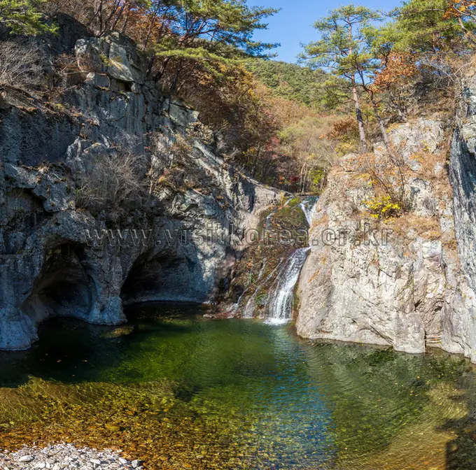
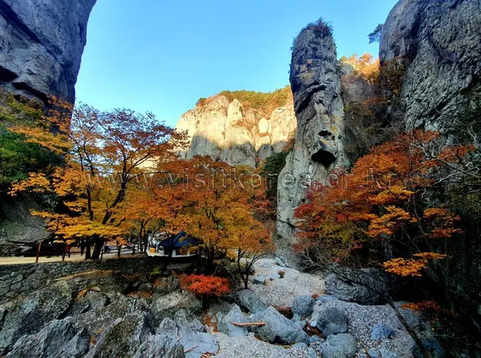
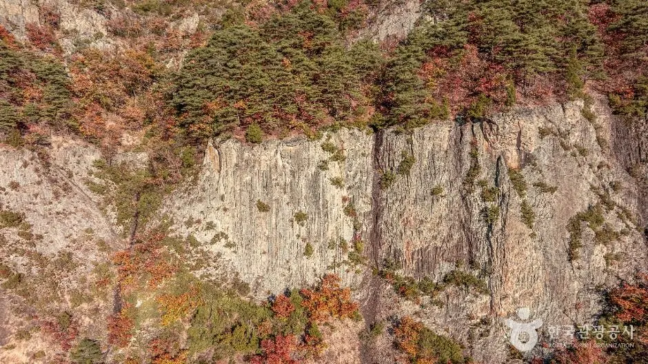
This guide covers Juwangsan National Park hiking trails that feel off the beaten path, you’ve found the right guide. Tucked away in North Gyeongsang Province, Juwangsan rewards hikers with dramatic rocky peaks, lush forest, and a peaceful atmosphere that’s a world away from Korea’s more crowded mountain destinations. Whether you’re a first-time visitor or a returning trekker, this guide covers everything you need to plan a safe and memorable day on the mountain.
Contents
Quick Facts
| Peak Altitude | 721m (Jubong Peak) |
|---|---|
| Distance (Jubong Loop Course) | 8.9 km (Loop) |
| Duration (Jubong Loop Course) | Approximately 4 hours 30 minutes |
| Difficulty (Jubong Loop Course) | Moderate |
| Main Trailhead | Daejeonsa (대전사) |
| National Park Entrance Fee | Free |
| Operating Hours | Sunrise to Sunset |
| Seasonal Closures | Spring: February 15 – May 15 / Autumn: November 15 – December 15 |
Getting to Juwangsan National Park
Juwangsan sits in a relatively rural part of Korea, so getting here takes a little planning — but that’s honestly part of its charm. The park doesn’t see the same weekend crowds as other major national parks, which means you’ll have a much more peaceful experience on the trail.
The most practical way to reach the park by public transport is to take an intercity bus to either Cheongsong Intercity Bus Terminal or Juwangsan Intercity Bus Terminal, and then transfer to a local bus that runs to the park entrance. Bus schedules and routes can change seasonally, so I recommend using Naver Map or KakaoMap to plan your journey in real time — these are the go-to navigation apps in Korea and are far more accurate for local transit than Google Maps, which doesn’t work reliably here.
To search for the park on Naver Map or KakaoMap, copy and paste this Korean text directly into the search bar: 주왕산국립공원. This will pull up the correct location and give you up-to-date directions from wherever you’re starting.
One important note: while the national park entrance is free of charge (all South Korean national park entrance fees were abolished in May 2023), Daejeonsa Temple, along with other major temples in national parks, has abolished its cultural heritage viewing fee as of May 2023. Entry is now free of charge for all visitors. Check before you go if you plan to visit the temple itself.
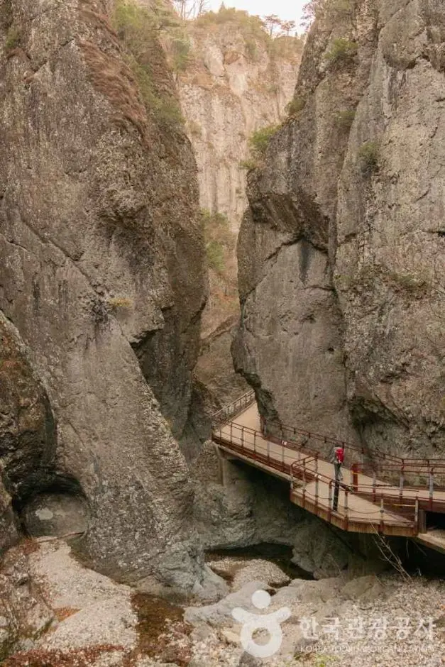
Trail Guide: The Jubong Course
The most popular route in the park is the Jubong Course, a loop trail that takes hikers up to Jubong Peak — the main summit of Juwangsan at 721 metres above sea level. Here’s a quick breakdown of what to expect:
- Distance: 5.8 km (loop)
- Estimated time: approximately 3 hours
- Difficulty: Moderate — suitable for reasonably fit hikers with basic trail experience
- Trailhead: Near Daejeonsa Temple (대전사), which serves as the main starting point for this and several other routes in the park
The Jubong Course is rated Moderate by the Korea National Park Service (KNPS), which means it’s accessible to most hikers who are comfortable with a few hours of uphill walking — but it’s not a casual stroll. Wear proper hiking shoes with ankle support, and make sure you’re carrying enough water and snacks for the full duration of the hike.
For full official trail maps and course details, visit the Official Juwangsan National Park Trail Information on the KNPS Website. The KNPS site is the most reliable source for up-to-date route conditions and any temporary trail closures.
If you’re interested in exploring beyond the Jubong Course, the park offers additional routes — check the KNPS website or Naver Map for real-time details on other available trails and their current status.

Practical Tips for Hiking Juwangsan
A few practical things to know before you set off, these apply to hiking in Korea generally, and Juwangsan is no exception.
Stock up at the CU in Juwangsan village
Korean mountain trails have no commercial facilities once you’re past the trailhead, no vending machines, no snack stalls, nothing. I’d suggest stopping at a convenience store near the trailhead or in the nearest town before you begin. Pick up enough water for the full hike, plus some energy snacks. These convenience stores are affordable, well-stocked, and easy to find near most national park entrances.
Pack Out Your Trash
There are no trash cans on Korean mountain trails. This is standard practice across all national parks in Korea, hikers are expected to carry everything back down with them. Bring a small bag to collect your wrappers and packaging, and leave the trail exactly as you found it. It’s a simple habit that keeps these beautiful spaces pristine for everyone.
Navigation in Korea
As mentioned above, Google Maps isn’t reliable for navigation in South Korea, it struggles with public transit routes and local addresses. Use Naver Map (available in English) or KakaoMap instead. Both apps give accurate bus routes, walking directions, and real-time transit information. To find Juwangsan National Park, search: 주왕산국립공원.
What to Wear and Bring
- Sturdy hiking shoes or trail runners with good grip
- Layers, mountain temperatures can drop quickly, especially in spring and autumn
- Sunscreen and a hat for exposed sections
- Enough water for the full hike
- Snacks and lunch if you plan a longer day
- A small trash bag for your waste
- A fully charged phone with Naver Map downloaded
Arrive Early
I’d suggest arriving at the trailhead as early as possible, especially on weekends and during peak autumn foliage season. An early start means cooler temperatures, better light for photos, and a quieter trail experience overall. Remember that all trails must be completed before sunset, as the park closes at dusk.
Seasonal Closures & Park Hours
This is one of the most important things to check before you visit. Juwangsan National Park, like all Korean national parks, implements seasonal trail closures for fire prevention. Based on available information, these closures typically fall during two periods:
- Spring: February to May
- Autumn/Winter: November to December
These are the periods when dry conditions make wildfires a serious risk, and the KNPS restricts access to certain trails or the entire park to protect the forest. The exact dates vary each year, so always confirm current closure status on the official KNPS website before you travel. Showing up to a closed trailhead after a long journey is a frustrating experience that’s entirely avoidable with a quick check online.
Outside of closure periods, the park is open daily from sunrise to sunset. Plan your hike so that you’re back at the trailhead well before dark.
Final Thoughts
Juwangsan National Park is one of those places that surprises people, it’s less famous than Korea’s headline mountain destinations, but that’s exactly what makes it special. The Jubong Course offers a satisfying moderate hike to a proper summit at 721 metres, all starting from the historic surroundings of Daejeonsa Temple, and the park’s relative quietness means you can actually enjoy the experience without fighting through crowds.
The logistics take a little more effort than visiting a park near Seoul, but the reward is a more authentic, peaceful day in the Korean mountains. Just remember to check the KNPS website for seasonal closures, stock up on supplies before you hit the trail, and use Naver Map (주왕산국립공원) to navigate your way there.
Have you hiked in Juwangsan National Park before, or is it on your Korea bucket list? Drop a comment below. I’d love to know which trail you’re planning to tackle first, or if you’ve any tips from your own visit to share with fellow hikers!
* Cover image source: ⓒ한국관광공사 포토코리아-이병현