This post may contain affiliate links. If you book or buy through these links, I may earn a small commission — at no extra cost to you. I only recommend things I genuinely find useful for your Korea trip.
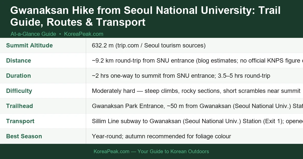
Planning a Gwanaksan hike from Seoul National University? You’re in for one of Seoul’s most rewarding mountain experiences — a 632.2 m peak with rocky ridges, a hermitage at the summit, and sweeping city views, all reachable by subway in under an hour from central Seoul.Contents
Getting There by Subway
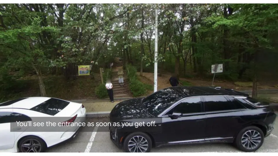
The easiest way to reach the trailhead is via the Sillim Line, which opened on 28 May 2022. Ride to Gwanaksan (Seoul National Univ.) Station and come out of Exit 1 — the Gwanaksan Park Entrance is literally about 50 metres from where you surface. It doesn’t get more convenient than that for a Seoul mountain hike.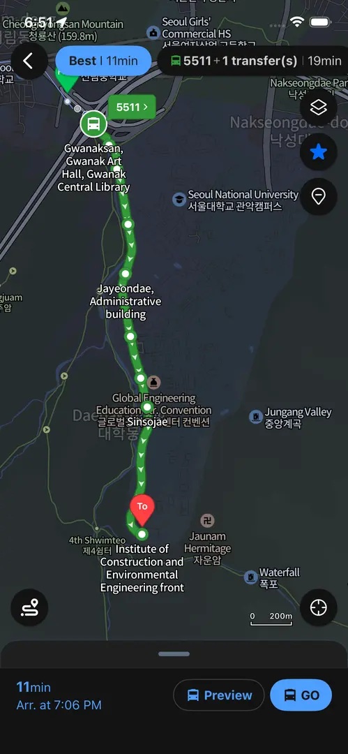
Trail Guide: SNU Entrance to the Summit
The First 20 Minutes: Into the Forest
From the park entrance, follow the well-marked signs pointing toward Yeonjudae — that’s the hermitage perched just below the summit and your ultimate destination. The first stretch winds through pleasant forest, and after roughly 20 minutes the trail merges near the Construction Environment Research Institute. From there, the path becomes more defined and the real climbing begins.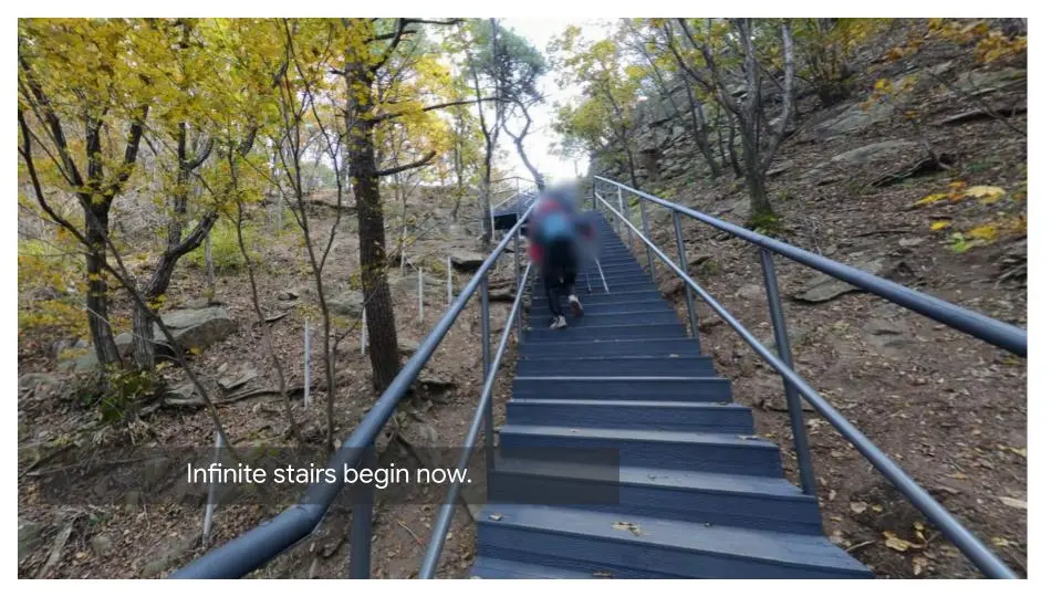
The Middle Section: Ridges and Rocky Steps
This is where Gwanaksan earns its reputation as a moderately hard mountain. Expect steep staircases cut into the hillside, exposed rocky ridges, and a few short scrambles as you approach the upper reaches. Trail shoes with solid grip are important here — smooth-soled sneakers are a bad idea on the wet rock sections. Budget around 2 hours one-way at a comfortable hiking pace.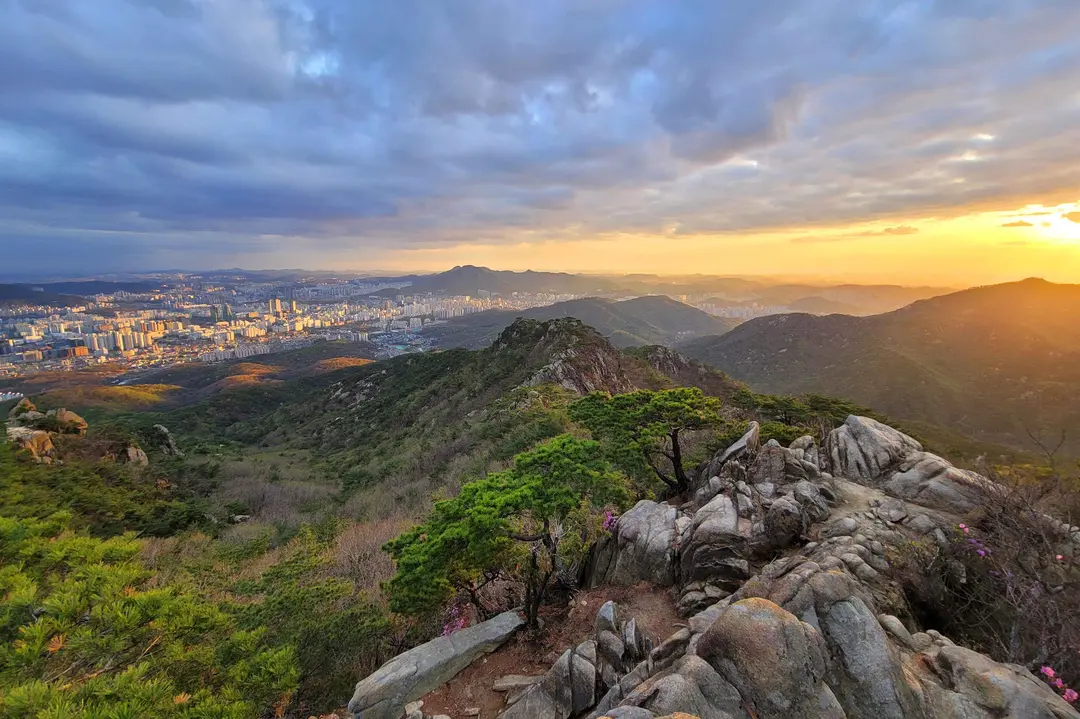
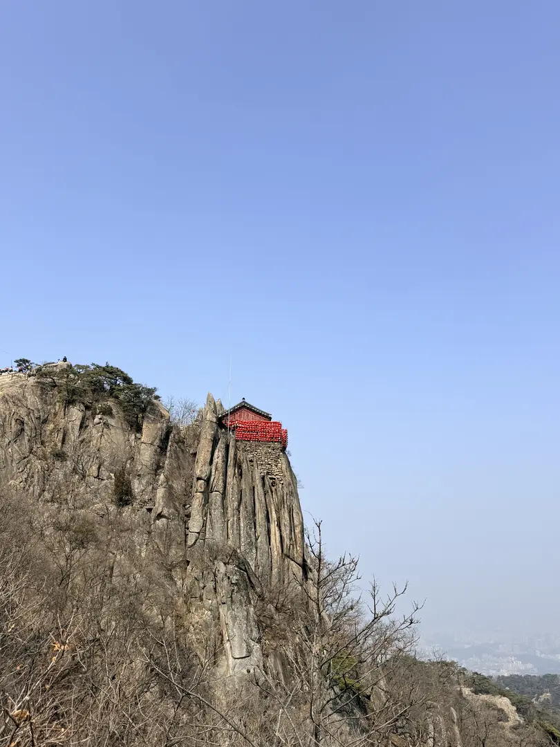
The Summit: Yeonjudae Hermitage
The reward at the top is Yeonjudae, a hermitage perched dramatically just below the 632.2 m summit. It’s one of the most photographed spots in Seoul’s mountains — and for good reason. On a clear day the panorama over the city is spectacular. Take your time up here before heading back down.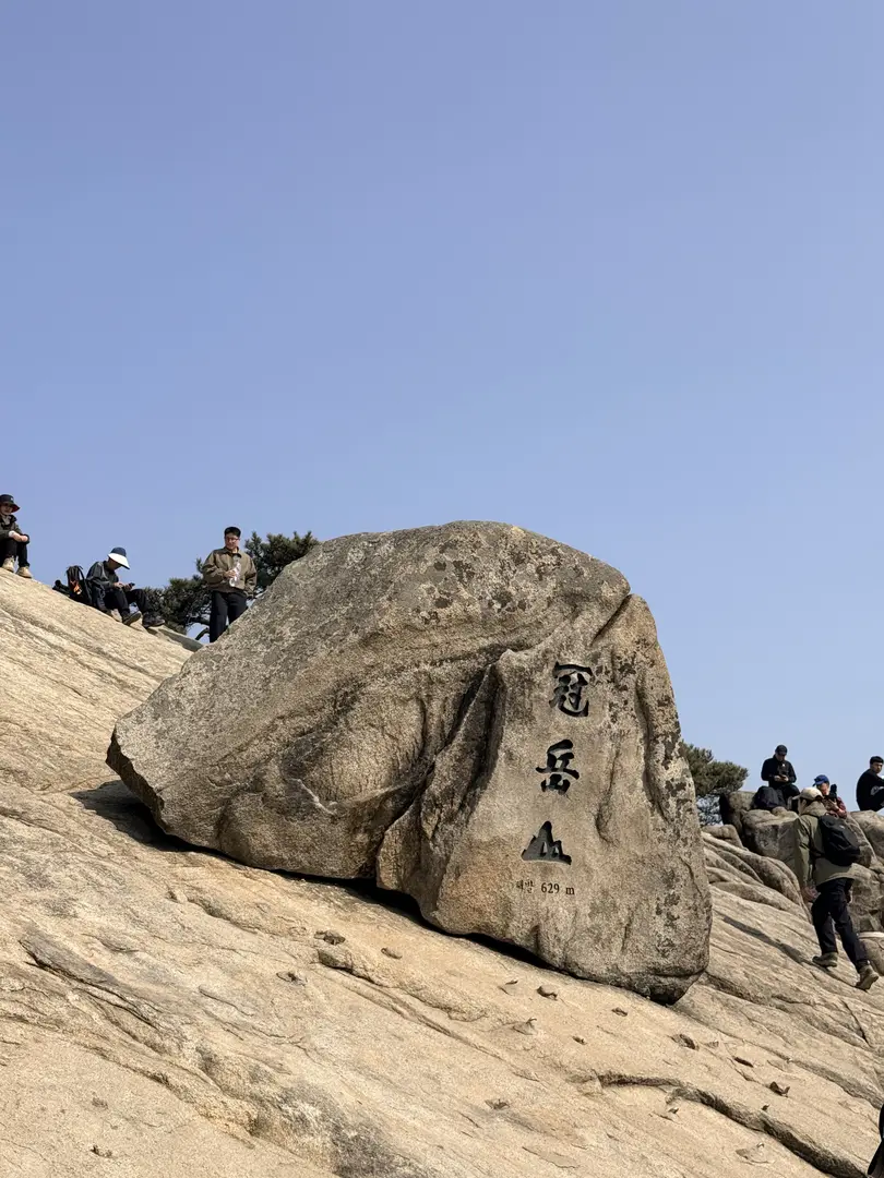
Descent Options
You can return the same way you came up, or consider the Gwacheon valley descent on the opposite side of the mountain, it’s generally considered less steep and less punishing on the knees than the SNU ascent route. If you’re feeling adventurous, Gwanaksan also connects via Palbong Ridge to Samseongsan Mountain, opening up longer routes for experienced hikers who want a bigger day out. For a standard round-trip via the same route, allow 3.5–5 hours depending on your pace and how long you linger at the top.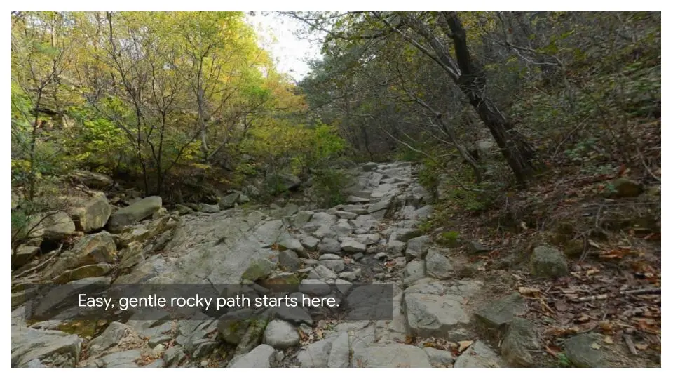
Practical Tips for Foreign Hikers
What to pack before the trailhead
This is non-negotiable: Korean mountain trails have no trash cans and no shops or vending machines on the trail. Before you enter the park, stop at a convenience store, there are CU and GS25 branches near the station, and buy all the water and snacks you’ll need for the entire hike. I’d suggest at least 1.5 litres of water per person; there are no reliable refill points along the route. And whatever you bring up, take all your trash back down with you. That’s just how Korean mountain culture works, and it’s why these trails stay so clean.What to Wear and Carry
- Trail shoes or hiking boots with good grip, essential for rocky and wet sections
- Enough water for the full round-trip (no on-trail refills available)
- Snacks purchased before entering the park
- A light rain layer. Seoul weather can change quickly
- Trekking poles if you’ve bad knees (gear rental available at the Seoul Hiking Tourism Center)