If you’re planning a Gamaksan Suspension Bridge DMZ tour, you’re in for one of the most rewarding — and historically charged — hikes in all of Gyeonggi Province. Sitting just south of the Demilitarized Zone, Gamaksan (감악산) rises to a peak of 675m and offers a trail experience that blends dramatic scenery with a genuine sense of frontier Korea. Whether you’re a seasoned hiker or a curious traveller looking to venture beyond Seoul’s city limits, this guide covers before you lace up your boots.
Contents
Quick Facts
| Peak Altitude | 675m |
|---|---|
| Distance (Out-and-back) | Approximately 7.0km – 8.0km (Full loop from Parking Lot via Suspension Bridge to the Peak and back) |
Why Gamaksan? The DMZ Hiking Experience
Gamaksan is one of those mountains that rewards you on multiple levels. Geographically, it sits in Paju — a city that most international visitors associate with the DMZ and the famous Imjingak area — which means the atmosphere here carries a quiet, almost solemn weight that you simply don’t feel on mountains closer to Seoul. The peak stands at 675m, which is modest enough to be accessible for most hikers yet tall enough to deliver sweeping views of the surrounding landscape.
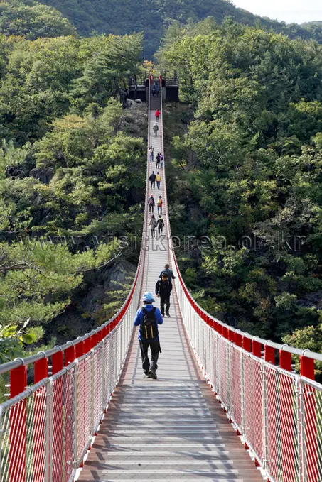
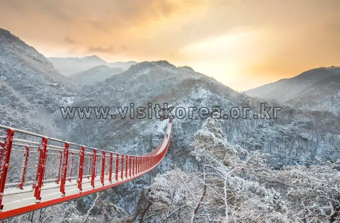
The headline attraction for most visitors is the suspension bridge, which serves as both a dramatic gateway to the upper trail and a photo opportunity in its own right. Crossing it — with the forested valley dropping away beneath you — sets the tone for the hike perfectly. This is the kind of experience that makes you feel like you’ve earned the summit before you’ve even reached it.
What makes a Gamaksan Suspension Bridge DMZ tour particularly special for international travellers is the layered context: you’re hiking in a region that was shaped by the Korean War, and on a clear day the proximity to the DMZ gives the landscape a meaning that goes far beyond the physical trail. It’s history you can feel in the air.
For more background on the mountain and the surrounding area, you can visit the official Visit Korea tourism page for Gamaksan, which provides additional context on the site.
Getting There
Here’s the first thing every international visitor needs to know about navigating Korea: Google Maps doesn’t work reliably here. Transit data, trail access points, and real-time directions are simply not accurate on Google in Korea. Instead, download Naver Map or KakaoMap — both are free, both work in English, and both will give you accurate public transit and driving directions.
To search for the mountain, copy and paste the Korean name directly into your map app:
- 감악산 — this is the Korean text for Gamaksan
- For the trailhead parking area or the suspension bridge starting point, search: 감악산 출렁다리 (Gamaksan Suspension Bridge)
Gamaksan is located in Paju, Gyeonggi Province. I’d suggest using Naver Map to plan your specific route from Seoul or wherever you’re staying, as bus routes and schedules in this area can change. The map app will show you the most current options, For the best public transit, take Bus No. 7700 (Double-decker bus, weekends only) from Geumchon Station or Bus No. 25 from Yangju/Uijeongbu.
If you’re driving, parking is available near the trailhead, check Naver Map for real-time parking information before you go. Taxis and ride-hailing apps (Kakao T is the most reliable) can also get you to the trailhead area, but confirm the drop-off point in advance, as some drivers may not be familiar with the exact suspension bridge access point.
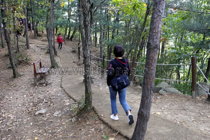
Trail Guide: Suspension Bridge to the Peak
The main route most visitors take is the out-and-back trail from the suspension bridge up to the 675m summit, a total distance of approximately 7.0km to 8.0km for the full round trip starting from the parking area. This is a manageable distance for most reasonably fit hikers, though the terrain does involve elevation gain, so don’t underestimate it.
Here’s a general breakdown of what to expect on the trail:
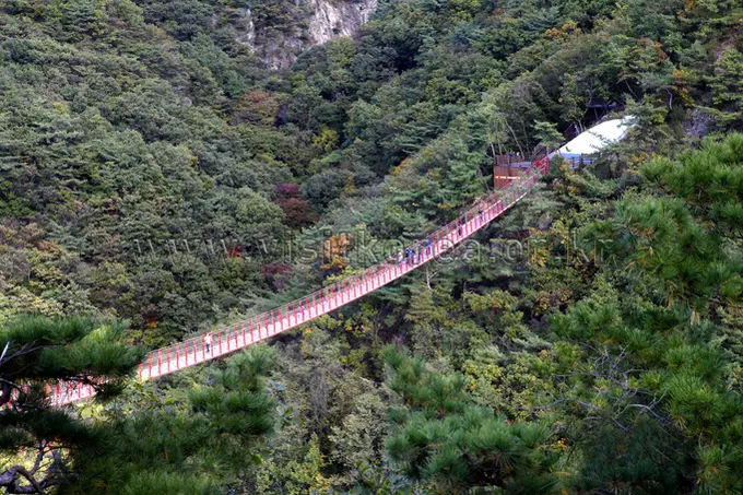
- The Suspension Bridge: This is your starting landmark and one of the most photographed spots on the mountain. Cross it early in the morning if you want it to yourself, it gets busy on weekends.
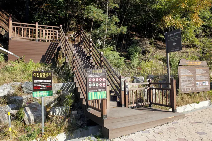
- The Ascent: After the bridge, the trail climbs toward the summit. The path is well-marked, but the gradient increases as you gain altitude. Take your time and pace yourself.
- The Summit (675m): The peak offers the payoff for your effort. On a clear day, the views toward the DMZ region are striking. This is a good spot to rest before heading back down.
- The Descent: Return via the same route. Descending can be harder on the knees than ascending, so trekking poles are a worthwhile investment if you’ve them.
Important: There are no shops, vending machines, or restaurants on the trail itself. Once you pass the trailhead, you’re entirely self-sufficient. Stock up on everything you need before you start.
Practical Tips for Visitors
Before You Go: Supplies & Preparation
Korean mountains operate on a strict leave-no-trace principle, and that includes trash cans. There are no bins on the trail. Everything you bring up, you carry back down. This is standard practice across all Korean hiking culture, and locals take it seriously. Pack a small zip-lock bag for your rubbish.
Before you reach the trailhead, stop at a convenience store to stock up. CU and GS25 are the two most common chains and you’ll find them in most towns near the mountain. Pick up:
- At least 1, 1.5 litres of water per person (more in summer)
- Energy snacks, kimbap, triangle rice balls (삼각김밥), energy bars, or nuts
- A small first aid kit if you’ve one
Seasonal Fire Prevention Closures
This is critical information that many international visitors miss: Korean mountains are subject to seasonal fire prevention closures, typically from January 20 to May 15 (Spring) and November 1 to December 15 (Autumn) in 2026. During these periods, access to certain trails, or the entire mountain, may be restricted or completely closed.
Before your visit, check the current closure status. I’d suggest checking the Paju City official tourism website or calling the local forest management office. You can also use Naver Map, which sometimes flags closure notices. Don’t assume the trail is open just because the weather looks fine, closures are enforced and wardens do patrol.
What to Wear & Bring
- Footwear: Proper hiking shoes or trail runners with grip. Sneakers aren’t ideal for the ascent.
- Layers: Mountain temperatures can be significantly cooler than in the city, especially near the summit. Bring a light windproof jacket even on warm days.
- Sun protection: Hat, sunscreen, and sunglasses, the exposed sections of the trail offer little shade.
- Trekking poles: Optional but helpful on the descent.
- Fully charged phone: For navigation and emergencies. Download your Naver Map route offline before you start, as signal can be patchy on the upper trail.
Best Time to Visit
I’d suggest arriving at the trailhead early, ideally before 9am on weekends. Gamaksan has grown in popularity, and the suspension bridge area in particular gets crowded by mid-morning. Weekdays are noticeably quieter.
In terms of seasons, autumn is widely considered the best time to hike in Korea, the foliage is spectacular and the air is crisp and clear. Spring (after the fire prevention closure lifts) is also beautiful. Summer hiking is possible but expect heat and humidity start very early if you go in July or August. Winter hiking is for experienced hikers only, ice on the trail requires crampons.
Safety & Etiquette
- Tell someone your hiking plan before you go, especially if you’re hiking solo.
- The emergency number in Korea is 119 (fire and rescue, including mountain rescue).
- Greet fellow hikers with a friendly “안녕하세요” (annyeonghaseyo), it’s standard trail etiquette and locals will appreciate it.
- Step aside on narrow sections to let faster hikers or descending hikers pass.
- Don’t pick plants or disturb wildlife.
Final Thoughts
A Gamaksan Suspension Bridge & DMZ Border Hiking is one of those experiences that surprises people. It’s not on every international travel itinerary, and that’s exactly what makes it worth doing. You get a real Korean mountain hike, a dramatic suspension bridge crossing, a 675m summit with views toward one of the most historically significant borders in the world, and the quiet satisfaction of being somewhere that most tourists never reach.
Just remember the essentials: download Naver Map, search for 감악산 출렁다리, stock up at a convenience store before the trailhead, carry your trash back down, and check for seasonal fire prevention closures before you go. Do those things, and you’re set for a memorable day out of Seoul.
Gamaksan rewards the prepared traveller. I hope this guide helps you be exactly that.
Have you hiked Gamaksan or explored the DMZ area before? I’d love to know, did the suspension bridge live up to the hype, or was it the summit views that really got you? Drop your experience in the comments below!
* Cover image source: ⓒ한국관광공사 포토코리아-한반도관광센터 비켄