If you’re looking for a rewarding day hike near Gwangju, this Mudeungsan National Park hiking trails guide has everything you need. Mudeungsan National Park rises to 1,187m at its highest peak, Cheonwangbong, and offers one of South Korea’s most distinctive mountain landscapes — defined by dramatic columnar joint rock formations that you simply won’t find anywhere else on the peninsula.
Contents
Quick Facts
| Altitude | 1,187m (Cheonwangbong), 1,100m (Seoseokdae, highest accessible peak) |
|---|---|
| Distance | Approximately 7.5km to 8.0km |
| Duration | 3.5 to 4 hours (one-way) |
| Difficulty | Medium |
| Trailheads | Wonhyosa (원효사), Jeungsimsa (증심사) |
| Transport | Bus 1187 to Wonhyosa. Bus 09 to Jeungsimsa (verify on Naver Map) |
| Entrance Fee | Free |
| Operating Hours | Sunrise to sunset (seasonal variations apply) |
| Seasonal Closures | Spring: February 15 – May 15 / Autumn: November 15 – December 15 |
About Mudeungsan National Park
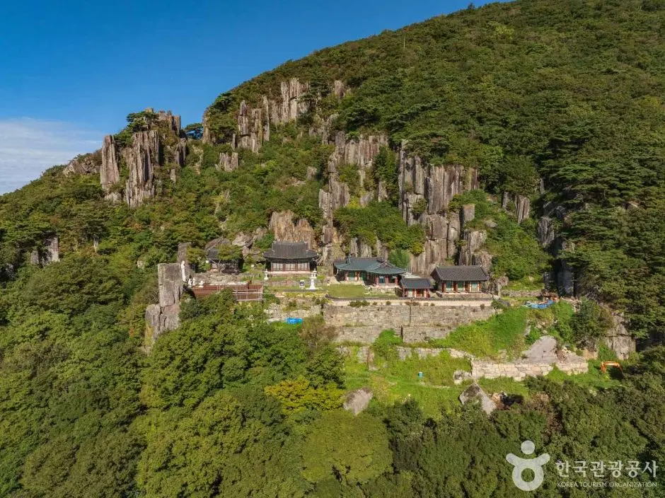
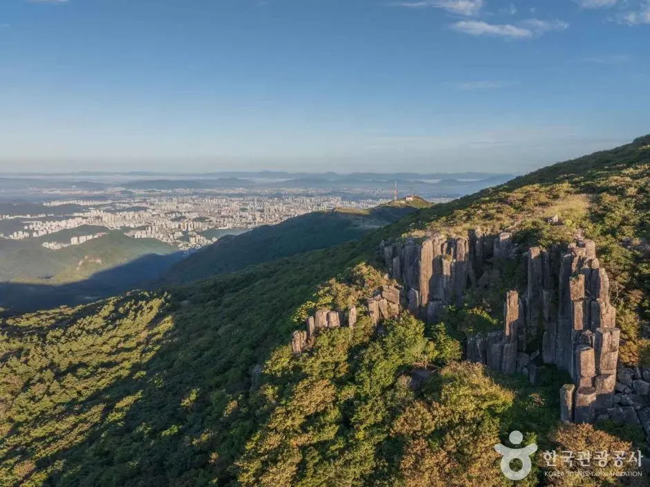
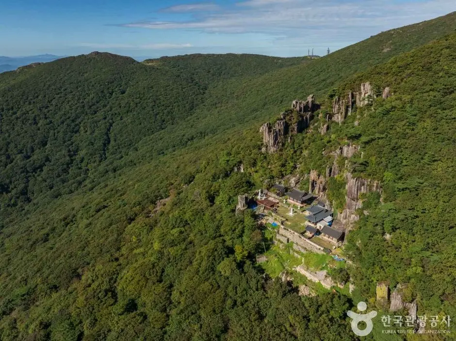
Mudeungsan — whose name loosely translates as “mountain without equal” — sits on the eastern edge of Gwangju. The park’s most iconic features are its columnar joint rock formations: Seoseokdae (서석대) and IpSeokdae (입석대). These towering columns of hexagonal rock look almost architectural, as if someone stacked enormous stone pillars by hand. They’re the main reason hikers make the trip, and they deliver.
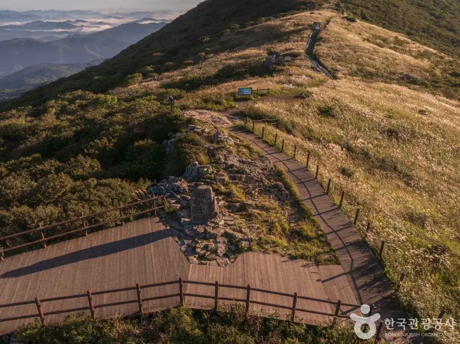
The summit, Cheonwangbong (천왕봉), tops out at 1,187m — but here’s something important to know before you plan your route: Cheonwangbong Peak (1,187m), which was restricted for 57 years, has been permanently opened to the public since September 2023. Hikers can now reach the highest summit daily. The highest point you can actually reach as a hiker is Seoseokdae at 1,100m. That said, the views from Seoseokdae are spectacular, and the columnar rock formations there are the real highlight of the mountain anyway. For full official park information, visit the Official Mudeungsan National Park Website (Korea National Park Service).
Getting There: Trailheads and Transport
Mudeungsan has two main trailheads — Wonhyosa (원효사) and Jeungsimsa (증심사) — and both are accessible by public bus from Gwangju city. The most popular approach is to start at Wonhyosa and finish at Jeungsimsa, making it a satisfying point-to-point hike rather than an out-and-back.
- To Wonhyosa: Take Bus 1187 from Gwangju city toward the Wonhyosa trailhead.
- To Jeungsimsa: Bus ‘Cheomdan 09’ (첨단09) serves the Jeungsimsa trailhead, but it doesn’t pass Gwangju Bus Terminal (U-Square). From the Terminal, take Bus ‘Suwan 03’ (수완03) or ‘Jinwol 07’ (진월07) to reach Jeungsimsa.
One critical heads-up for international visitors: Google Maps doesn’t work reliably in South Korea. I recommend using Naver Map or KakaoMap instead, they’re accurate, up-to-date, and widely used by locals. To search for your destination, copy and paste the Korean text directly into the app:
- Wonhyosa trailhead: 원효사
- Jeungsimsa trailhead: 증심사
Bus routes and schedules can change, so always double-check current numbers and timings on Naver Map before you head out. Taxis from central Gwangju are also a convenient option if you prefer a direct ride to the trailhead.
Trail Guide: Wonhyosa to Jeungsimsa via Seoseokdae
The flagship route in any Mudeungsan hiking trails guide is the Wonhyosa. Seoseokdae. Jeungsimsa course, a 9.0km one-way trail rated medium difficulty, with an estimated hiking time of approximately 5 hours one-way. It’s a well-established point-to-point route that takes you through the heart of the park and past both of the famous columnar rock formations.
Here’s a breakdown of the key points along the route:
- Wonhyosa (원효사): Your starting point. This is where you’ll begin your ascent toward the upper reaches of the park.
- IpSeokdae (입석대): One of Mudeungsan’s signature columnar joint rock formations. The columns here are striking, take your time and enjoy them.
- Seoseokdae (서석대): At 1,100m, this is the highest point accessible to hikers and the crown jewel of the trail. The columnar rock formations here are among the most impressive natural features in the mountains surrounding Gwangju.
- Jeungsimsa (증심사): Your finishing point, where you can catch a bus back into Gwangju city.
Because this is a one-way trail, you’ll want to plan your transport in advance, decide whether you’re catching a bus or taxi from Jeungsimsa back to your accommodation. I’d recommend checking the last bus times before you start hiking so there are no surprises at the end of a long day on the trail.
Practical Tips for Hiking Mudeungsan
A few practical things that’ll make your day on the mountain much smoother:
There Are No Shops or Trash Cans on the Trail
This is one of the most important things to understand about hiking in Korean national parks: there are zero commercial facilities past the trailhead. No vending machines, no snack stalls, no restaurants, nothing. And there are no trash cans anywhere on the trail either. Pack everything in, pack everything out. That’s the rule, and it’s enforced.
Before you start hiking, stock up at a convenience store near the trailhead. Chains like CU and GS25 are common in Korean cities and towns, grab your water, snacks, and anything else you need before you hit the trail. Carry enough water for the full duration of your hike.
What to Bring
- Sufficient water for the full hike, there are no refill points on the trail
- Snacks and lunch (buy at a convenience store near the trailhead)
- A small bag for your trash to carry back down
- Layers, mountain temperatures can drop significantly compared to the city below
- Sturdy hiking shoes with good grip
- A fully charged phone with Naver Map downloaded offline if possible
- Sunscreen and a hat for exposed sections near the summit
No Night Hiking Allowed
Mudeungsan National Park strictly prohibits night hiking. Access is limited to between sunrise and sunset, with seasonal variations. I’d recommend starting early, not only to stay well within the time limit, but also to avoid the midday heat in summer and to give yourself a comfortable buffer for the 5-hour one-way trail.
Seasonal Closures and Park Rules
This is something many visitors overlook, and it can seriously affect your plans, so pay attention. Certain sections of Mudeungsan National Park are subject to seasonal closures for fire prevention:
- Spring closure: February 1 to May 15
- Autumn closure: November 1 to December 15
These closures apply to some sections of the park, not necessarily the entire trail network, but it’s essential to check which routes are affected before you visit. Always confirm current trail status on the Official Mudeungsan National Park Website (Korea National Park Service) or contact the park office directly before your trip if you’re visiting during these windows.
A few other park rules worth knowing:
- Entrance to the park is completely free.
- Carry all your waste back down, no exceptions.
- Stay on marked trails and respect any closed-off areas.
- Cheonwangbong summit is a military restricted zone, don’t attempt to access it.
Final Thoughts
Mudeungsan is one of those mountains that rewards you in ways you don’t fully expect. Yes, you come for the hike, but what stays with you’re those extraordinary columnar rock formations at Seoseokdae and IpSeokdae, rising out of the ridgeline like something from another world. The 9.0km Wonhyosa-to-Jeungsimsa route is a satisfying full-day trail at medium difficulty, and the fact that it’s completely free to enter makes it one of the best-value hikes in the country.
Plan your transport with Naver Map, stock up at a convenience store before you start, check the seasonal closure dates, and you’re set for a brilliant day in the mountains above Gwangju. The mountain will take care of the rest.
Have you hiked Mudeungsan before, and did you manage to catch Seoseokdae on a clear day? Drop your experience in the comments below. I’d love to hear which season you visited and whether you tackled the full point-to-point route!
* Cover image source: ⓒ한국관광공사 포토코리아-배근한