This guide covers the ultimate Deogyusan winter hiking guide, you’ve come to the right place. Deogyusan National Park is one of Korea’s most rewarding winter destinations — a place where snow-dusted ridgelines and crisp mountain air make every step worth the effort. Whether you’re a seasoned trekker or tackling your first Korean national park, this guide covers before you lace up your boots.
Contents
Quick Facts
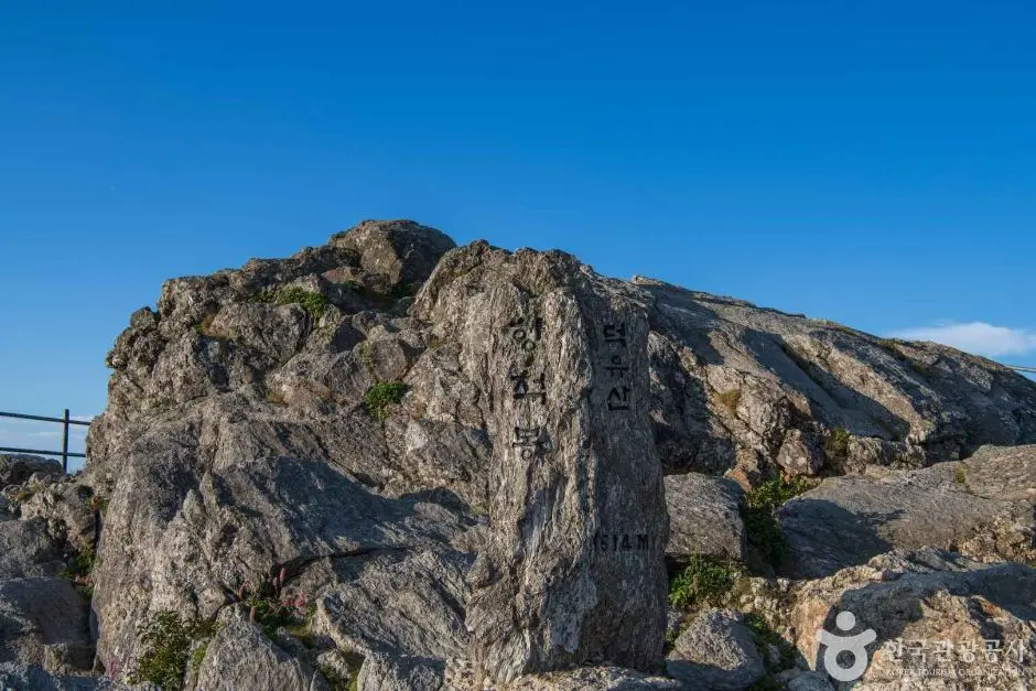
| Altitude | 1,614m (Hyangjeokbong Peak) |
|---|---|
| Distance (Gucheon-dong → Hyangjeokbong) | 8.5km one-way, 17km round-trip |
| Duration (Gucheon-dong → Hyangjeokbong) | 4 hours one-way, 8 hours round-trip |
| Difficulty | Moderate (보통) |
| Trailhead | Gucheon-dong Visitor Center (구천동탐방지원센터) |
| Transport | Local bus from Muju-eup to Gucheon-dong |
| Entrance Fee | Free |
| Operating Hours (Winter) | Entry restricted after 13:00 (November–February) for the Gucheon-dong to Hyangjeokbong course. |
Getting to Deogyusan
Deogyusan National Park is located in Muju County. The main trailhead for the classic winter route is the Gucheon-dong Visitor Center (구천동탐방지원센터). To get there, make your way to Muju-eup first — accessible by intercity bus from major cities — and then hop on a local bus heading to Gucheon-dong.
Bus frequency is approximately hourly, but schedules can change seasonally. I recommend checking the current timetable on Naver Map before you travel. Here’s an important heads-up for international visitors: Google Maps doesn’t work reliably in Korea. Instead, use Naver Map or KakaoMap — both are free and work excellently for public transport routing. To search for the trailhead, copy and paste this into Naver Map: 구천동탐방지원센터. It’ll pull up the exact location with live bus information.
Trail Guide: Gucheon-dong to Hyangjeokbong
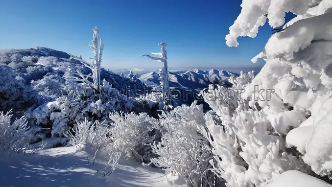
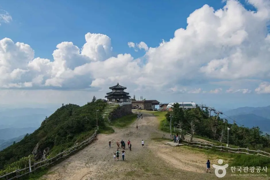
The main winter hiking route runs from the Gucheon-dong Visitor Center up to Hyangjeokbong Peak, the highest point in Deogyusan at 1,614 metres. The trail is rated moderate (보통) by the Korea National Park Service — challenging enough to feel like a real achievement, but accessible to hikers with a reasonable level of fitness and proper preparation.
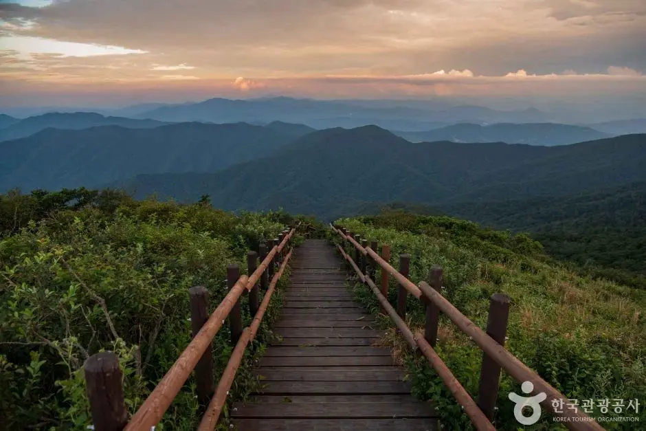
The one-way distance is 8.5km, and most hikers complete the ascent in around 4 hours. The full round-trip — 17km — takes approximately 8 hours. That’s a full day on the mountain, so planning your start time is critical in winter.
Here’s the most important rule to remember: trail entry is restricted after 14:00 (2:00 PM) from November through February. Rangers enforce this cutoff strictly for safety reasons, winter days are short, and getting caught on a high ridge after dark is dangerous. I’d suggest starting early to give yourself a comfortable buffer for the summit and the descent.
For the most up-to-date trail information and course maps, visit the Official Deogyusan National Park Trail Course Guide on the Korea National Park Service website.
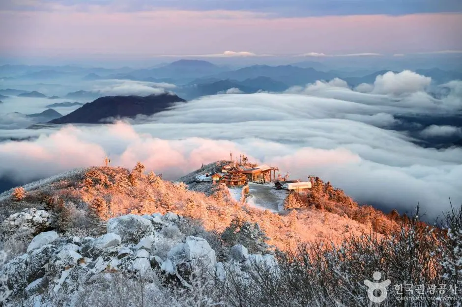
The Gondola Shortcut
Not ready for the full 8.5km slog? There’s a brilliant alternative. You can take the Muju Resort gondola up to Seolcheonbong, from where Hyangjeokbong is just a 0.6km hike away. This option makes the summit accessible for families, older hikers, or anyone who wants to experience the winter panorama without committing to a full-day trek. During the winter season (typically mid-October to February), online reservations are mandatory for the gondola on weekends and public holidays. You must book in advance via the Muju Deogyusan Resort website.
Practical Tips for Winter Hiking
Winter hiking in Korea requires a bit more preparation than a summer stroll. Here’s what I’d tell any visitor heading up Deogyusan in the cold months:
Gear & Clothing
- Wear moisture-wicking base layers and insulating mid-layers, temperatures near the summit can be significantly colder than at the trailhead.
- Bring microspikes or crampons, icy sections are common on Korean mountain trails in winter and can make descents treacherous without traction devices.
- Pack a windproof outer shell; ridge-level wind chill can be brutal.
- Trekking poles are highly recommended for stability on snowy or icy terrain.
- Wear warm, waterproof hiking boots, trail conditions can shift from packed snow to slush depending on the time of day.
Food, Water & Waste
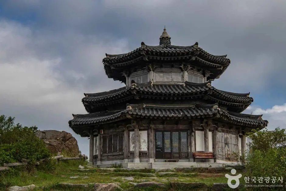
- While most of the trail has no facilities, you’ll find the Hyangjeokbong Shelter (향적봉대피소) just 100 meters below the summit. It sells basic snacks, bottled water, and simple hiking gear like ice cleats (spikes).
- There are also no trash cans on the trail. You must carry all your waste back down, this is both the rule and the culture in Korean hiking.
- Stock up on water, snacks, and lunch near Muju-eup before boarding the bus to Gucheon-dong.
- Bring more water than you think you need, cold air is dehydrating even when you don’t feel thirsty.
- High-calorie snacks are popular choices among Korean hikers for long mountain days.
Safety & Timing
- Start early, the 14:00 trail entry cutoff is non-negotiable in winter (November. February).
- Check the weather forecast before you go. Mountain weather can change rapidly; what’s clear at the trailhead may be a whiteout at the summit.
- Let someone know your planned route and expected return time.
- Dress in layers you can add or remove, body temperature fluctuates significantly during ascent and descent.
- The entrance to Deogyusan National Park is completely free of charge, in line with all Korean national parks.
Trail Closures & Fire Prevention Periods
One thing many international visitors don’t know about Korean national parks is the seasonal fire caution period. Deogyusan observes two such periods each year:
- Spring: February 1. May 15
- Autumn: November 1. December 15
During these windows, the main trail from Gucheon-dong to Hyangjeokbong typically remains open, but the ridge trail from Hyangjeokbong to Namdeogyusan is usually closed. This overlaps directly with the winter hiking season, so it’s essential to check which trails are open before you make the trip. The Korea National Park Service website is the most reliable source for real-time closure information, or use Naver Map to check for any posted notices near the trailhead.
Final Thoughts
Deogyusan in winter is special, a high-altitude escape that rewards early risers and well-prepared hikers with some of the most dramatic cold-season scenery in Korea. The classic route from Gucheon-dong to Hyangjeokbong is a satisfying full-day challenge at a moderate difficulty level, while the gondola option from Muju Resort offers a more accessible path to the summit for those who want the views without the full commitment.
The key to a great day on the mountain is simple: start early, stock up before you leave Muju-eup, pack your microspikes, and carry everything back down with you. Respect the 14:00 entry cutoff, it exists for good reason, and always double-check trail closures during the fire prevention periods.
Remember to use Naver Map (search: 구천동탐방지원센터) rather than Google Maps for navigation in Korea, and check the Official Deogyusan National Park Trail Course Guide for the latest route and closure updates before your visit. Happy hiking, and stay safe out there!
Have you hiked Deogyusan in winter before? Did you take the full Gucheon-dong route or use the gondola shortcut, and which would you recommend to a first-timer? Drop your experience in the comments below!
* Cover image source: ⓒ한국관광공사 포토코리아-노희완