Inwangsan (인왕산, 338.2 m) sits less than 30 minutes from central Seoul by subway, and most visitors to the capital never climb it. They walk the palace district below and glance up at the granite ridgeline — and keep moving. On an overcast or rainy day, that is the most wrong it gets.
Light rain was falling by the time I reached the upper ridge. The greens on the pine slopes had gone electric. The fortress wall was dark with moisture, storm clouds were stacking over the Han basin, and there was almost nobody on the trail. Inwangsan in rain is a different mountain from Inwangsan on a clear Saturday morning.
The route follows Hanyangdoseong (한양도성), Seoul’s Joseon-era city wall, from the tiger-statue trailhead near Cheongunde Park (청운공원) up to the 338.2 m summit, with a descent toward Dongnimmun Station (독립문역, Line 3). Fully subway-accessible at both ends — no car, no shuttle, no reservation.
The Tiger Guardian of Inwangsan
The stone tiger stands at the park entrance on a low granite plinth, its body reclined, facing the road. The inscription on the pedestal reads 문화강국 호랑이 — the tiger of Inwangsan. — the tiger of Inwangsan. Inwangsan has long carried the name Tiger Mountain; the statue makes the association literal. To the left, a park information board. Behind it, the trail begins.
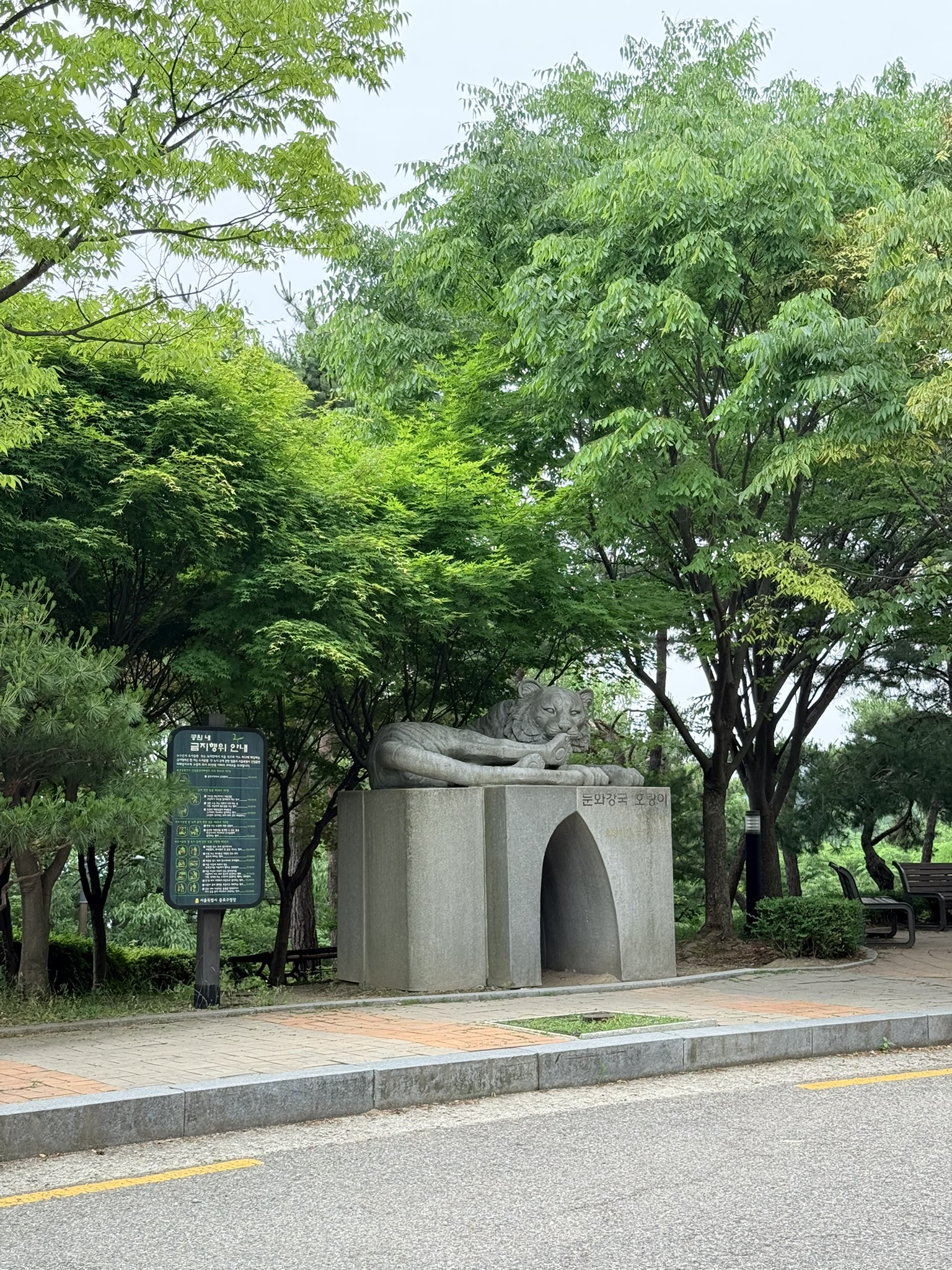
Summer trees crowd the entrance in full leaf — pale gray sky showing through the canopy. On a rainy day, this entrance is quieter than usual. Most people who arrive here have already decided to go up regardless of the forecast.
Reading the Trail Map
The 인왕산 안내도 (Inwangsan Mountain Guide Map) near the trailhead shows the full route network. Two sections of the Hanyangdoseong trail run across Inwangsan: the 종로구간 (Jongno section, 5.1 km) and the 서대문구간 (Seodaemun section, 3.3 km). The summit — 인왕산정상 (338.2 m) — sits in the upper portion of the map, with trail branches connecting to Changuimun (창의문) in the northwest and the Donuimun site (돈의문터) to the southeast.
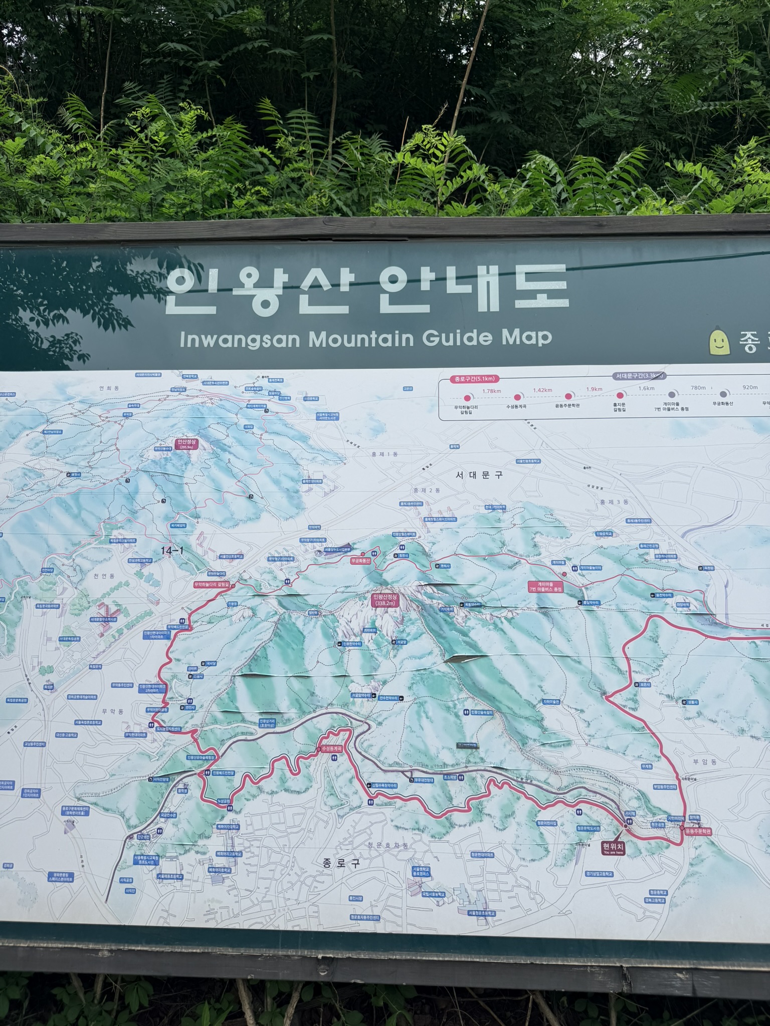
The map shows multiple entry and exit points. The practical note: approach from the Cheongunde Park tiger statue, summit via either section, and descend toward Dongnimmun on the Seodaemun side — a clean one-way traverse with no backtracking.
The First Climb: Stone Steps and the City Wall
The Hanyangdoseong wall appears within the first few minutes. Granite blocks — large, tightly fitted, each one substantial — run along the right side of a stone staircase climbing through the canopy. Left side: dense deciduous trees and pine, lush after rain, the leaves catching gray light. The staircase follows the wall line upward and disappears into the tree cover.
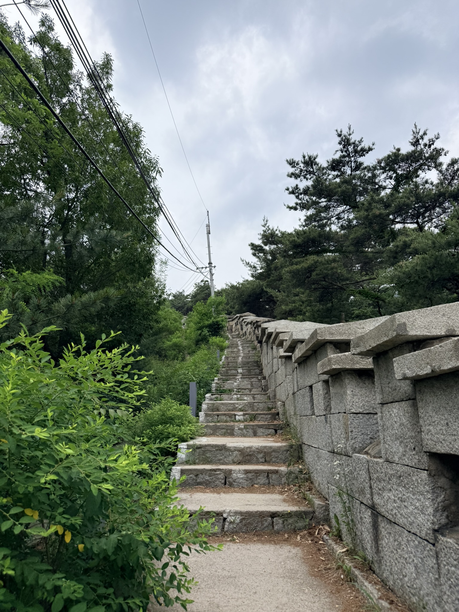
The grade is steady and continuous. No technical terrain yet — the first section is a long, deliberate stair climb with the ancient wall as constant company. Damp granite underfoot on the cut stone, but grip holds.
Upper Granite Terrain: Rope Railings and Storm Sky
Higher up, the paved staircase gives way to the mountain itself. Steps are cut directly into natural granite — rough, granular, worn smooth at the center of each tread. Rope railings run on metal posts along the left edge. To the right at this junction: a CCTV pole and a directional signpost. The sky above has gone from overcast to actively threatening, the cumulus dark-based and building fast.
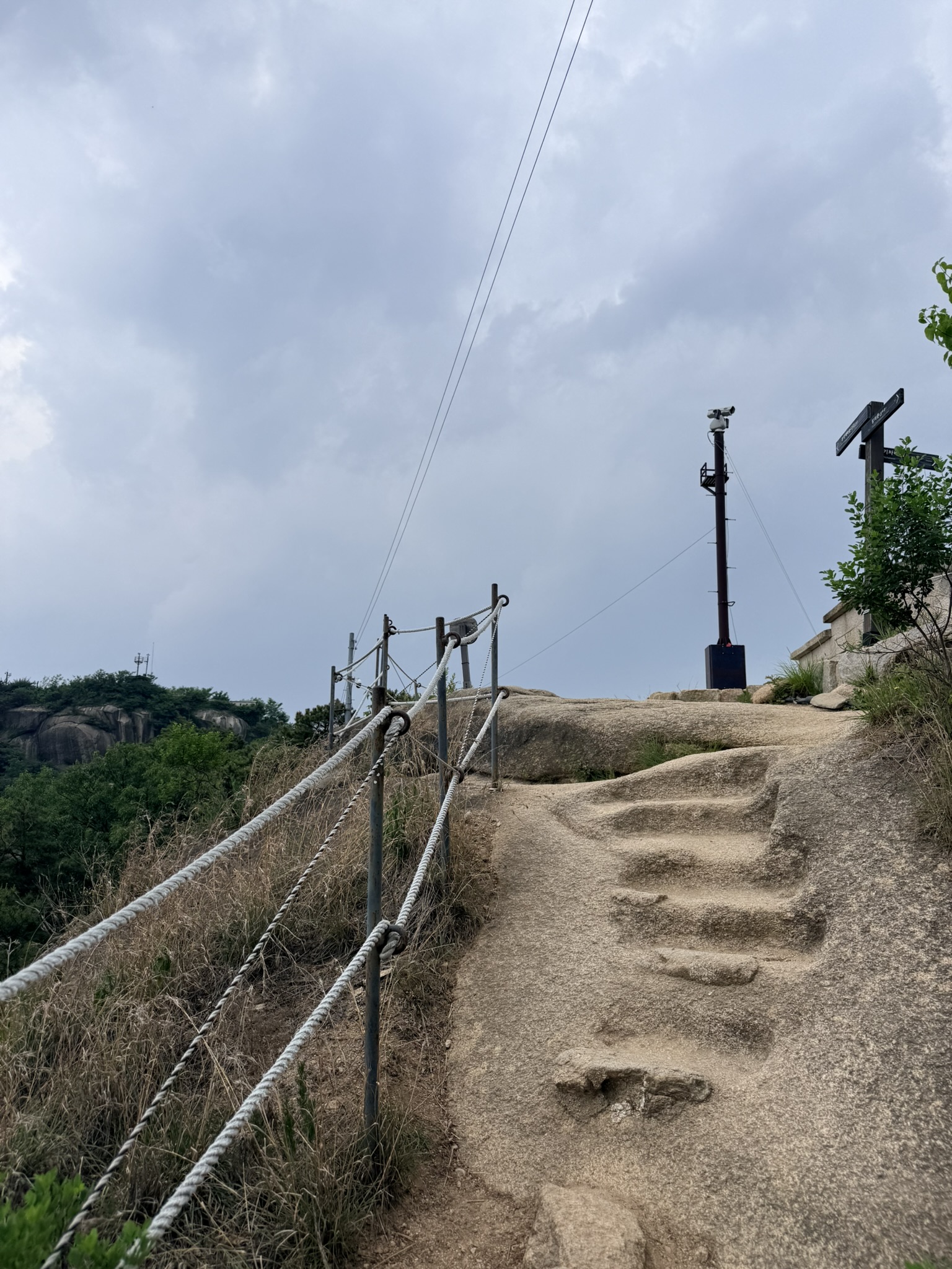
The granite ridgeline of a neighboring peak shows through the cloud layer to the left. Move efficiently here — when the sky looks like this on Inwangsan, rain is close.
Seoul in the Overcast
The first full city view opens on the right side of the upper trail. Seoul spreads in every direction — apartment blocks and office towers receding into a silvery haze under flat cloud. N Seoul Tower (남산타워), on Namsan hill to the southeast, sits as a clear spire silhouette against the pale background. Green ridge in the foreground, the full urban scale behind.
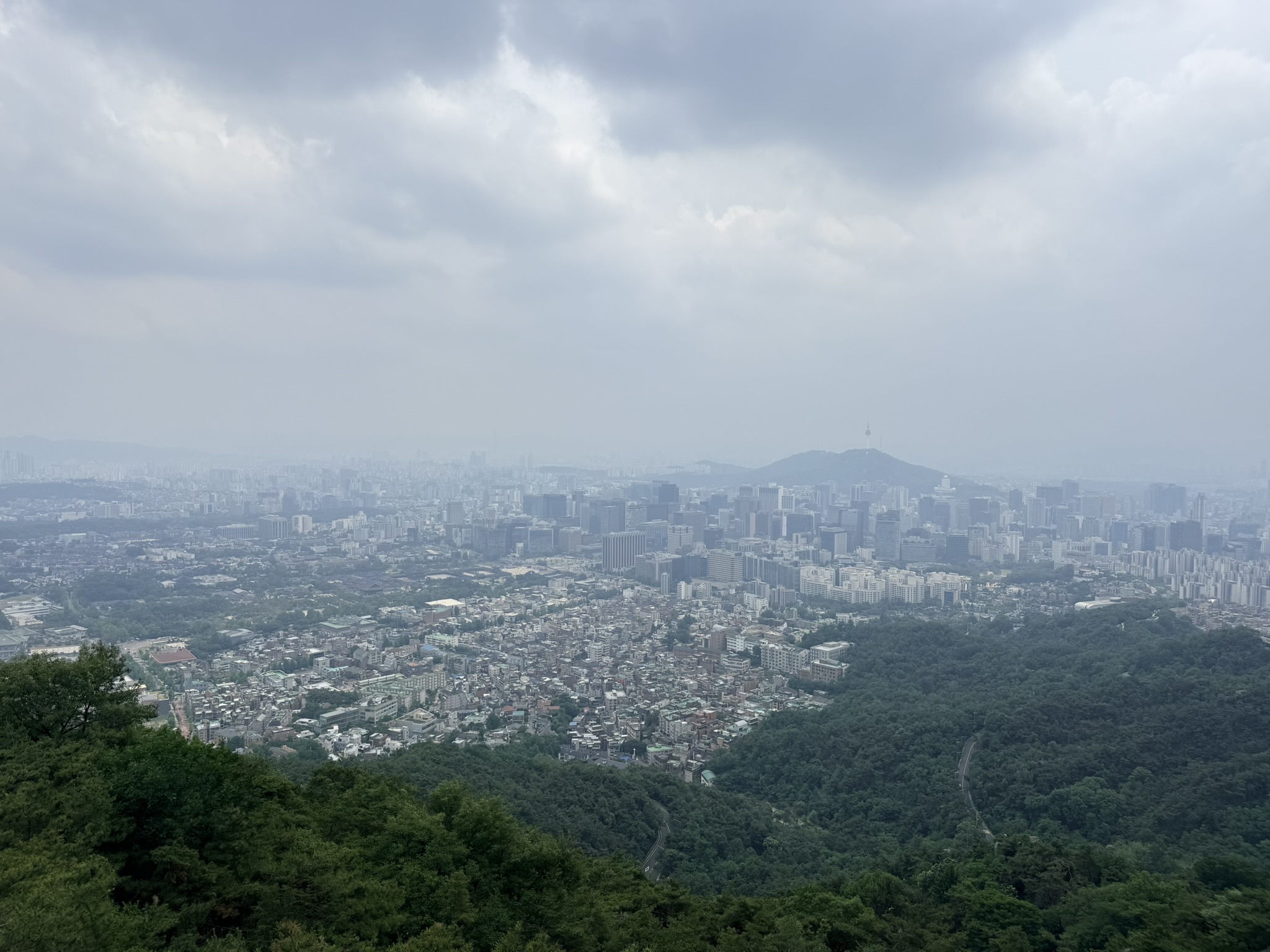
Overcast changes the reading of this view. The haze compresses distance, and the layers of hills and buildings become a sequence of planes rather than a flat backdrop. Clear days are bright and sharp; this version trades clarity for atmosphere — and on that trade, the overcast wins.
Inwangsan’s Granite Ridge
Away from the city view, the ridge itself takes over. A rounded granite dome rises ahead — pale gray, streaked with faint mineral banding, the rock faces curved by erosion. Pine trees grow out of every crack, their roots gripping stone. Below the rock faces, pine-covered slopes fall away steeply. In the far background, layered mountain ranges dissolve into the haze, apartment towers just visible at their base.
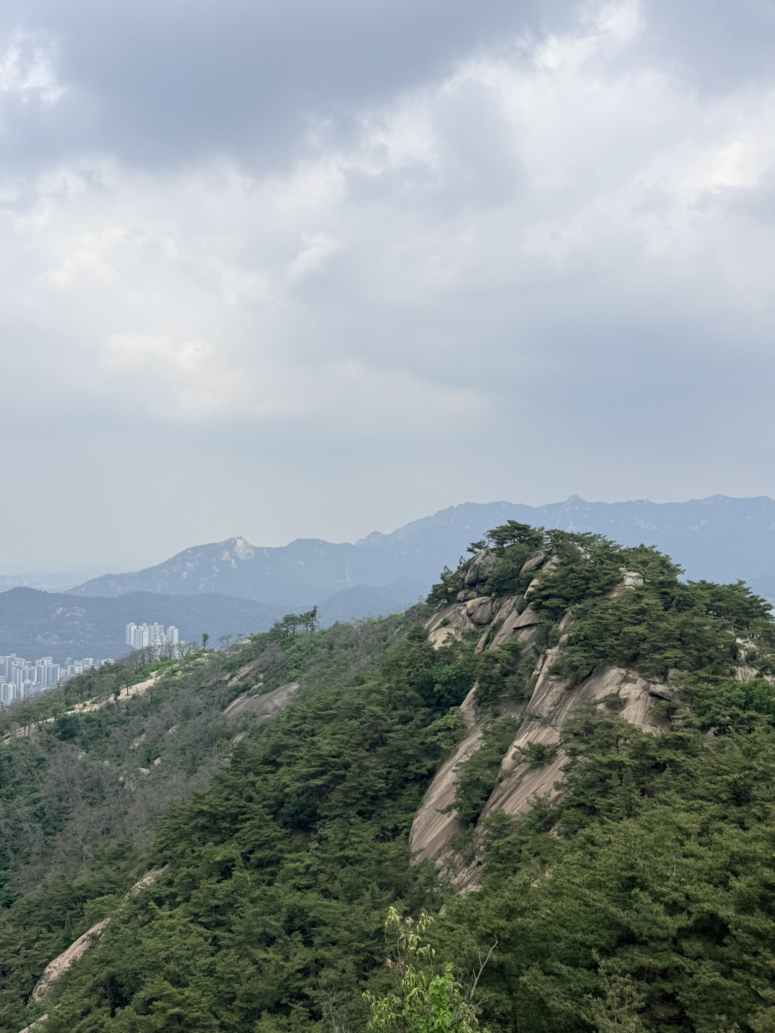
This is Inwangsan’s geological identity. Seoul sits on a ring of this granite — the same material runs through Bukhansan (북한산) to the north, Naksan (낙산) to the east. Inwangsan shows it closest to the city center, with the clearest exposure on the upper slopes.
Walking the Hanyangdoseong Wall
Closer to the summit, the trail runs tight against the outer face of the Hanyangdoseong wall. Dirt and stone steps climb alongside the battlement line — the rectangular embrasures cut into the parapet at regular intervals on the right. Above the wall, a large granite dome rises with pines clustered at its top and along its flanks.
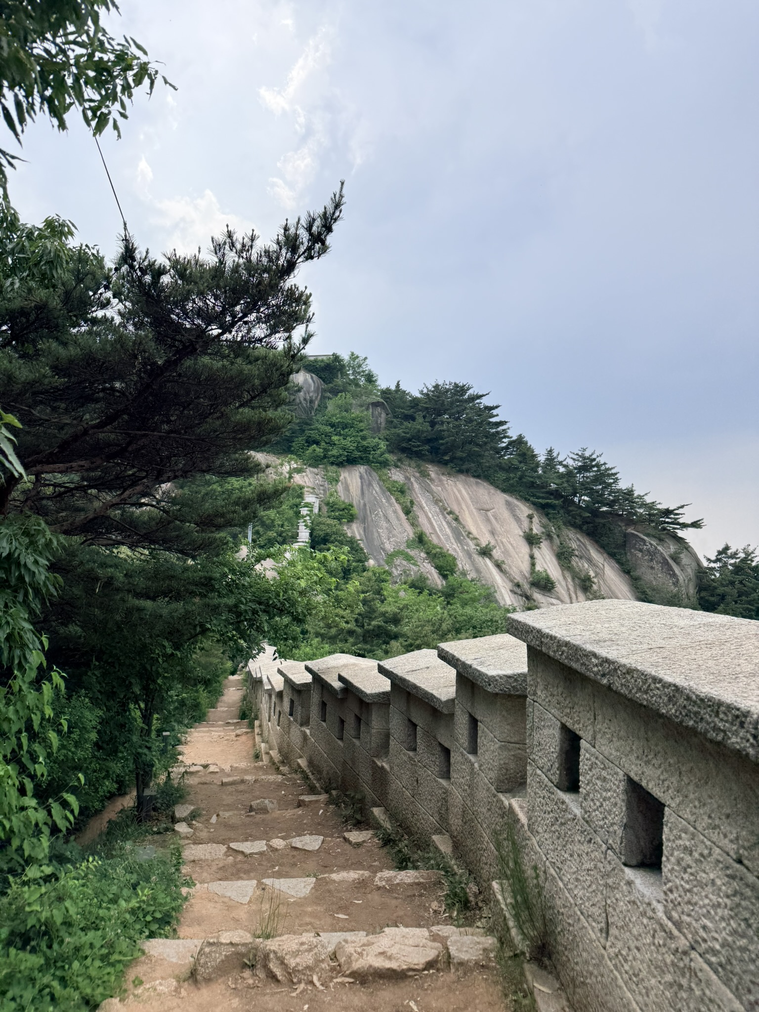
The Hanyangdoseong (한양도성) is a Joseon-era defensive wall that encircles the four inner mountains of Seoul. The Inwangsan section is one of the steeper stretches — the wall follows the terrain without compromise. Standing beside the granite masonry with the slope dropping away on the other side, the scale of the construction is hard to miss.
The Final Steep Push
The last section before the summit is direct. A metal staircase — dark steel, open-grate steps with anti-slip tread, solid handrails on both sides — rises at a steep angle across bare exposed granite. Viewed from below looking up, the stairs narrow toward a vanishing point of pine silhouettes and storm sky.
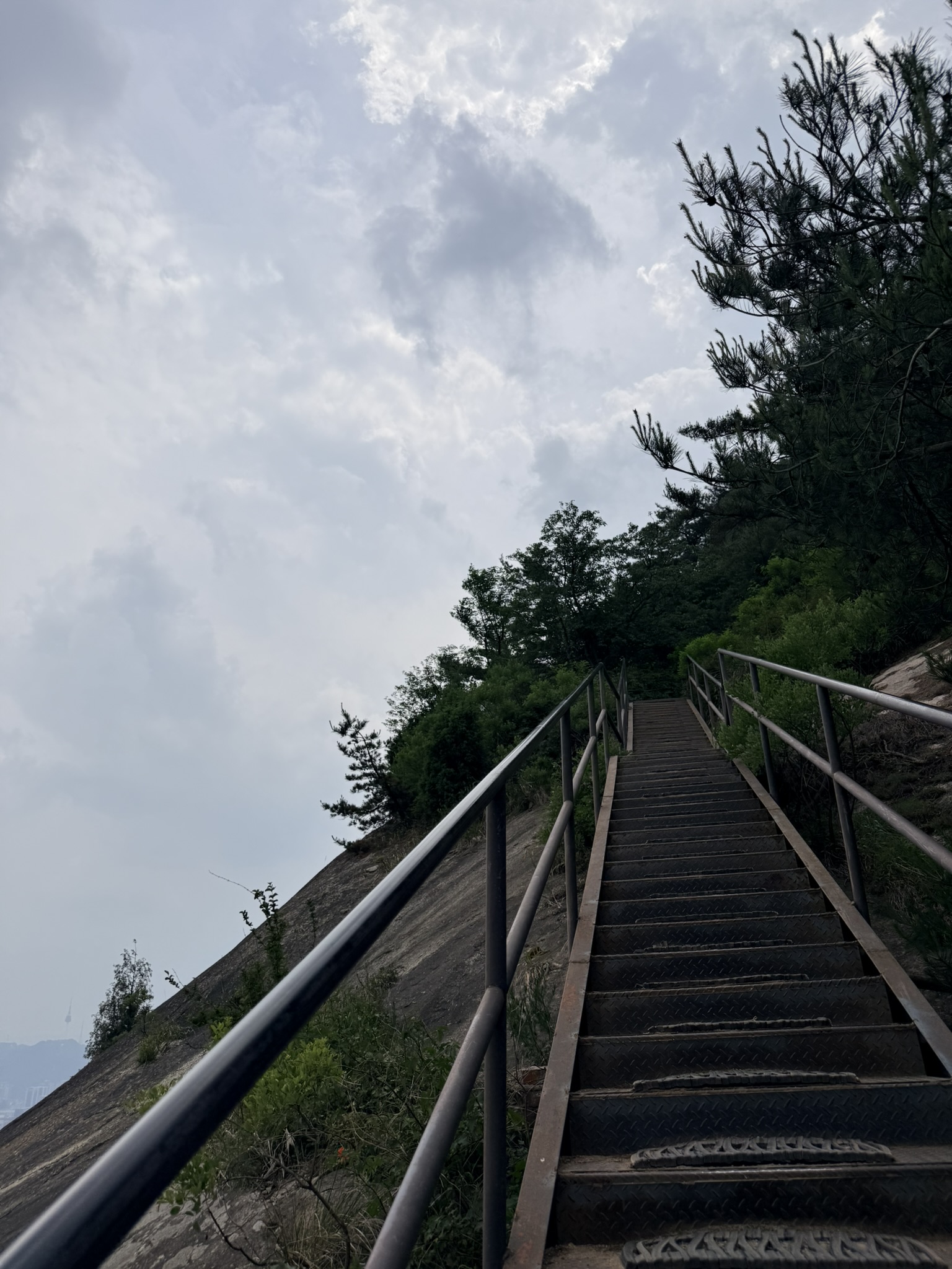
This is the section where the rain angle matters most. Bare granite in wet conditions without the stairs would be a different proposition. The stairs are stable; the pitch is real. Take the ascent at your own pace — the summit is close.
Summit: 인왕산정상 338.2 m
Two signs mark the top. A weathered wooden board, dark brown with white-painted characters: 인왕산정상 / 338.2m / 종로구. Next to it, a gray information panel — 서울 한양도성 순성길 (Excursion Trail of Hanyangdoseong) — with trail distances in both directions: → 2.5 km to the Site of Donuimun Gate (돈의문터) / ← 1.8 km to Changuimun Gate (창의문).

The Donuimun direction leads southeast toward Seodaemun and Dongnimmun Station — the standard exit for a one-way traverse. Changuimun goes northwest toward Buam-dong (부암동).
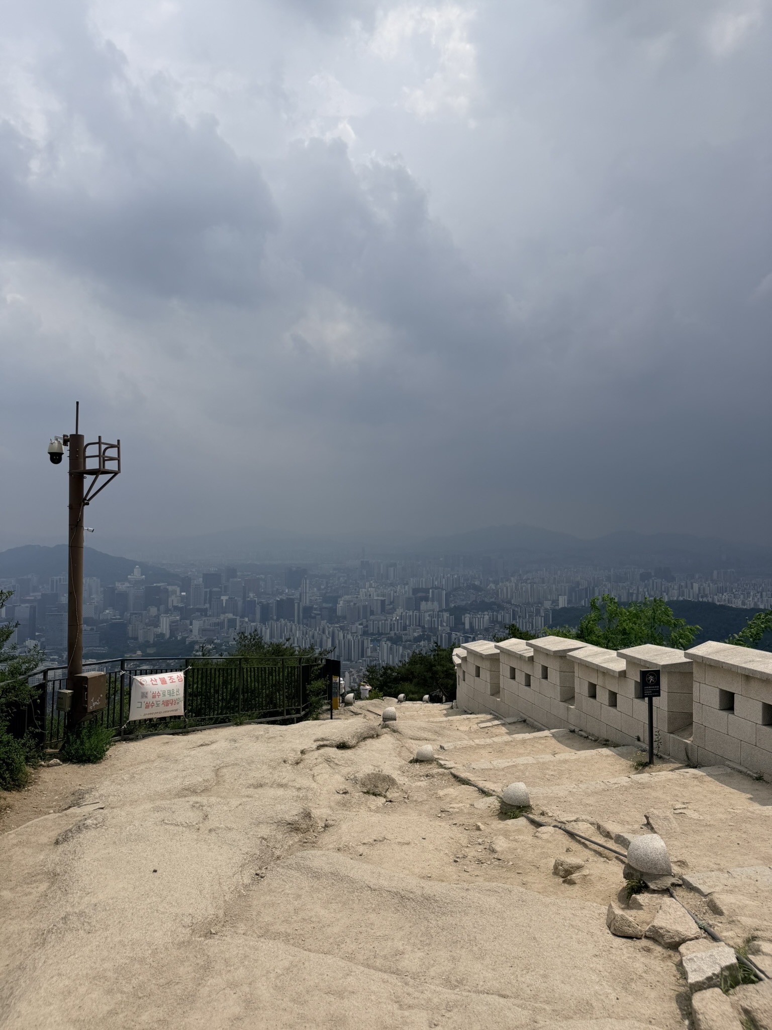
The summit plateau is open granite, sandy at the surface. On a stormy day only a handful of people were up here. The Hanyangdoseong battlements run along the eastern edge. A CCTV pole and a red 산불조심 (forest fire warning) banner stand to the left. Below the plateau edge, Seoul fills the basin in every direction — and directly above, the sky has done what the clouds were threatening all climb. Dark cumulus over the southeastern city, the buildings below still pale and lit. The contrast is stark enough to stop moving for.
The Cat in the Wall
One of the rectangular embrasure slots in the fortress wall — the openings built for archers — had a resident. A calico cat, brown and black and white, had settled into the dry granite alcove. Paws tucked in, eyes forward, entirely unbothered by the approaching storm.
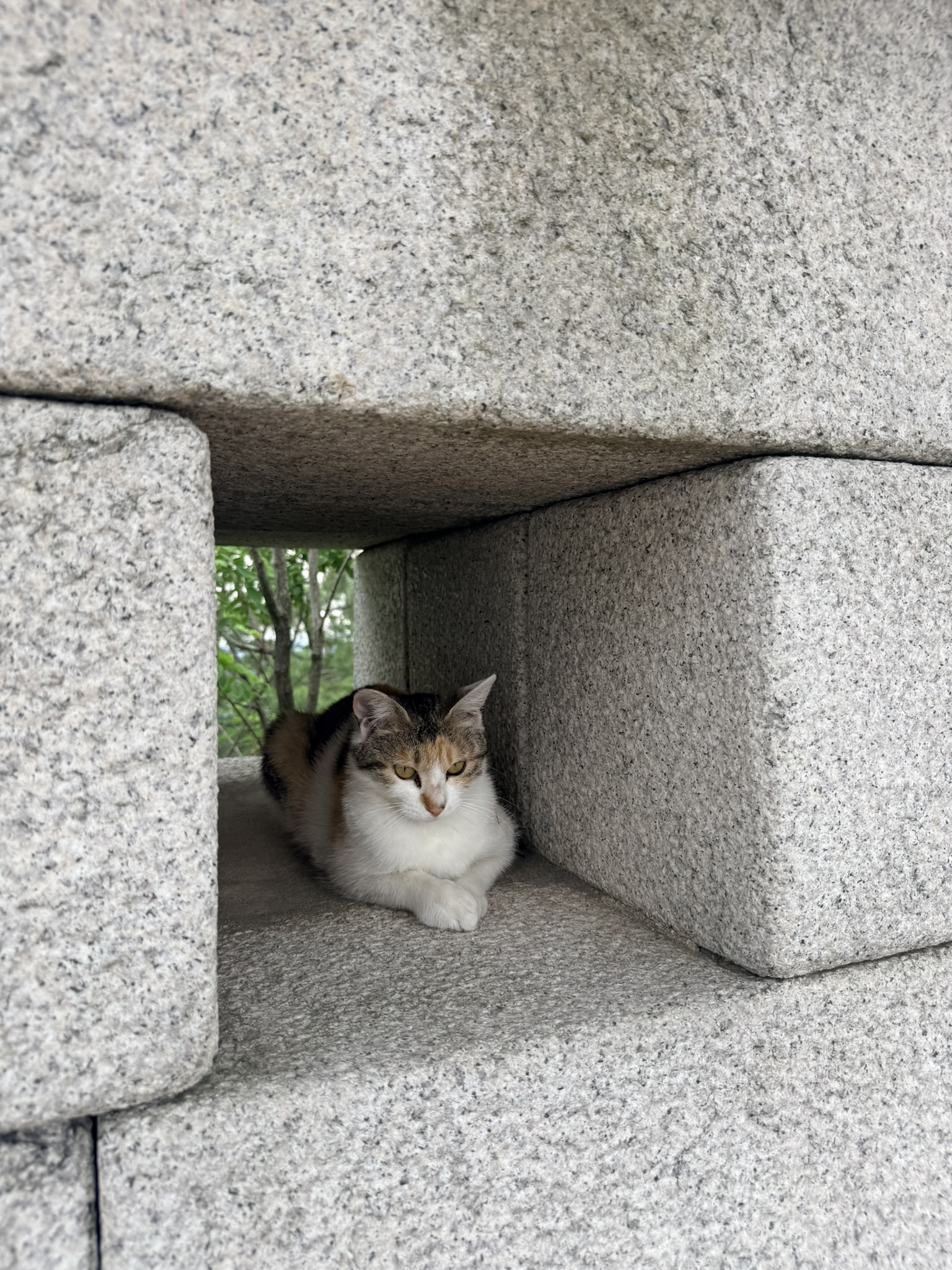
Trail cats are regulars on Seoul’s city mountains, where hikers often leave food. This one had identified the best available shelter on a stormy summit. A firing slot in a Joseon-era city wall, repurposed.
The Wall from Above, the City Below
From the summit rocks, looking back along the ridge, the Hanyangdoseong wall becomes visible as a continuous feature — a pale stone line tracing the ridge crest below, curving with the terrain, individual battlements just distinguishable at distance. Pine-covered slopes fall away on both sides. Beyond the wall line, Seoul’s apartment towers fill the valley. Lotte World Tower (롯데월드타워) is a thin vertical stroke in the right-frame haze.
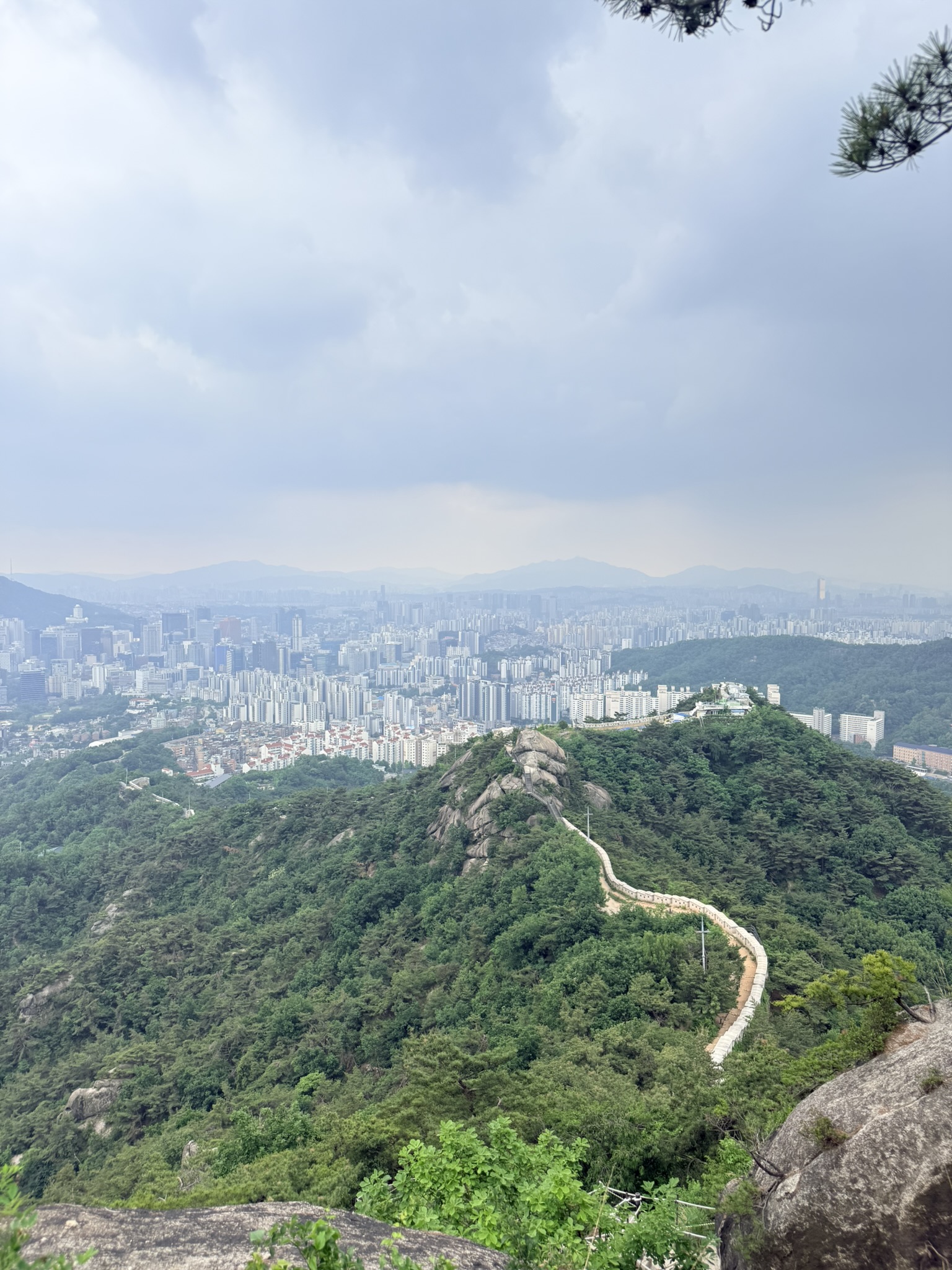
This view makes Inwangsan legible as what it is: a mountain inside a city, with the wall as the structural hinge between the two.
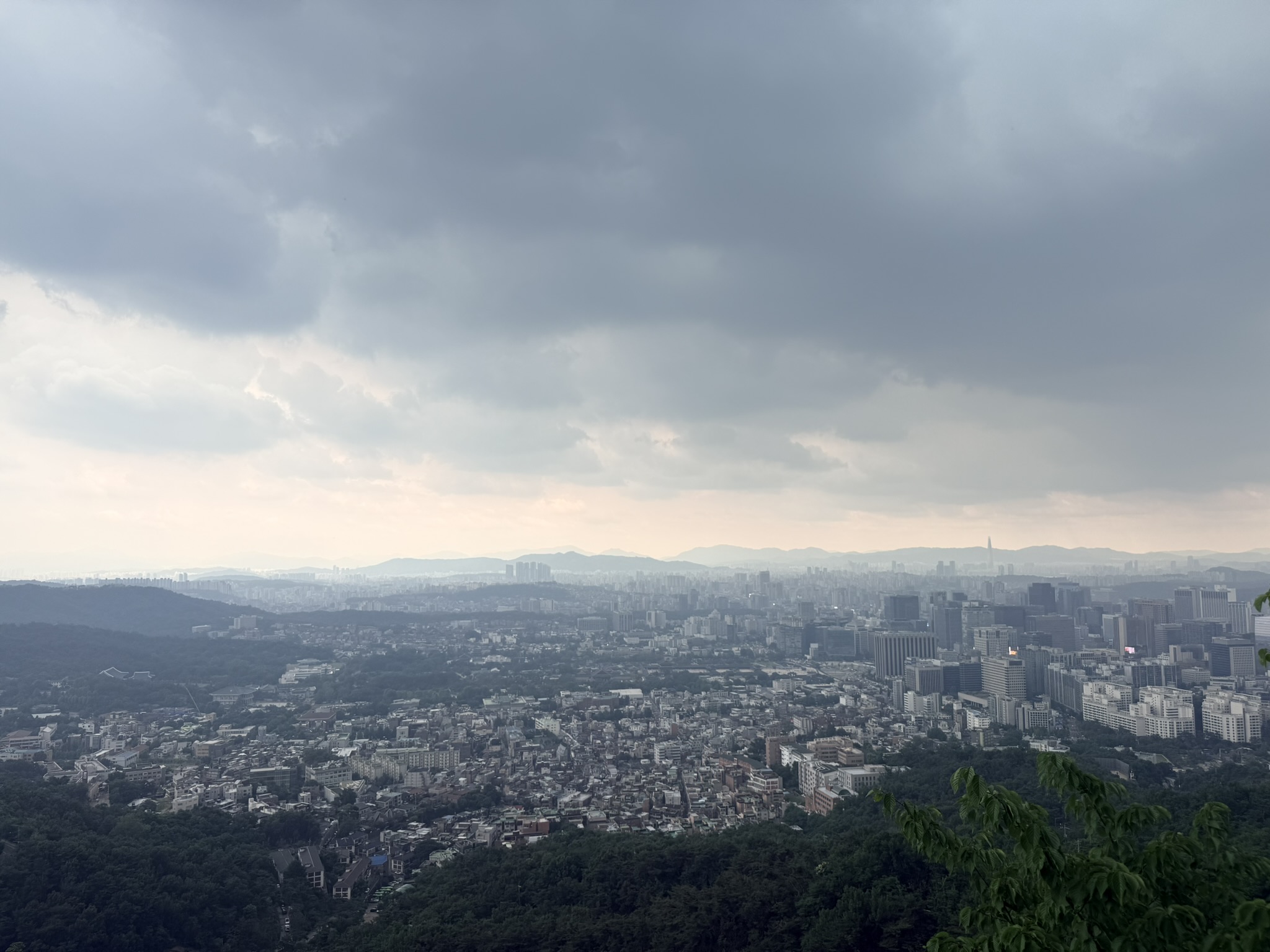
The final panorama looks southeast over the full spread of the city under pre-storm light — flat silver-gray that bleaches distance and sharpens mid-ground detail. Seoul reads as a nearly continuous surface of rooftops out to the mountain rim. Lotte World Tower holds its position at the far right. The Han River basin is a dull-silver band in the haze. The storm that had been building all morning was arriving.
Start at the tiger statue near Cheongunde Park (청운공원). From central Seoul, Gyeongbokgung Station (경복궁역, Line 3) is the closest subway stop; the trailhead is reachable on foot west through the Chebu-dong neighborhood or by local bus from the station area. Descend via the Hanyangdoseong wall toward Donuimun Gate site and exit at Dongnimmun Station (독립문역, Line 3) — one subway line, no transfers on that leg.
Trail shoes handle the lower stone steps without issue. On the upper granite and metal stairs in rain, they’re sufficient; hiking boots give more confidence on wet rock. The metal staircase on the final push has anti-slip tread. The bare granite sections earlier are where care is needed.
Have you hiked Inwangsan in Seoul — in rain or clear weather? Leave a route note in the comments, especially if you’ve done the full Hanyangdoseong circuit through both the Jongno and Seodaemun sections.